

- Usage in publication:
-
- Cocksfield Ferry beds
- Modifications:
-
- Original reference
- Dominant lithology:
-
- Sand
- Clay
- AAPG geologic province:
-
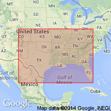
- Arkla basin
Summary:
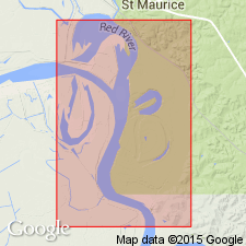
Pg. 220. Cocksfield Ferry beds. Lignitiferous sands and clays, which in a general way represent the Claiborne sands of Alabama. Underlie Jackson stage and overlie Lower Claiborne stage [=St. Maurice formation of present (ca. 1936) nomenclature]. [Age is middle Eocene.]
[Named from Cockfield Ferry (correct spelling), on Red River, near Petite Ecore, Winn Parish, northwestern LA.]
Source: US geologic names lexicon (USGS Bull. 896, p. 479).

- Usage in publication:
-
- Cockfield formation†
- Modifications:
-
- Abandoned
- AAPG geologic province:
-
- Arkla basin
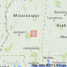
- Mid-Gulf Coast basin
Summary:
The term "Cocksfield Ferry beds" was later [post-1895] changed to Cockfield member of Claiborne formation. Afterward the Claiborne was elevated to a group and Cockfield to a formation. In 1912 the equivalency of Cockfield formation of Louisiana with Yegua formation of Texas was established, and "Cockfield" was dropped for the earlier name, Yegua formation.
Source: US geologic names lexicon (USGS Bull. 896, p. 479).
- Usage in publication:
-
- Cockfield lignite
- Modifications:
-
- Original reference
- Dominant lithology:
-
- Clay
- Lignite
- AAPG geologic province:
-
- Arkla basin
Summary:
Pg. 77. Cockfield lignite. Lignitic clays and lignites, with abundant impressions of leaves of land and marsh plants. Thickness 30 to 40 feet. Named from Cockfield Ferry [Winn Parish], Louisiana. Top member of Lisbon formation in Mississippi. [Age is middle Eocene.]
[GNC remark (ca. 1936, US geologic names lexicon, USGS Bull. 896, p. 479): According to C.W. Cooke (personal commun. Dec. 1936) the beds described above are same as Cockfield formation of other authors, now replaced by Yegua formation. The Yegua overlies Lisbon formation. †Cockfield lignite abandoned.]
Source: US geologic names lexicon (USGS Bull. 896, p. 479).
- Usage in publication:
-
- [Cockfield formation]
- Modifications:
-
- Areal extent
- AAPG geologic province:
-
- Arkla basin
Summary:
Pg. 119-142. [Cockfield formation.] Described in Caldwel and Winn Parishes, northwestern Louisiana, where it overlies Little Natches member (new) of Cook Mountain formation. Underlies Jackson group. Name Cockfield has been in common use in Louisiana since 1905, although there have been many suggestions to alter it. [Age is middle Eocene.]
Source: US geologic names lexicon (USGS Bull. 1200, p. 864-865).
- Usage in publication:
-
- Cockfield formation
- Modifications:
-
- Revised
- AAPG geologic province:
-
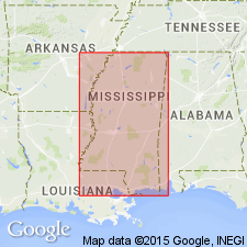
- Mid-Gulf Coast basin
Thomas, E.P., 1942, The Claiborne: Mississippi Geological Survey Bulletin, no. 48, 96 p.
Summary:
Pg. 68-73. Cockfield formation. In this report, formation is expanded to include all beds below Moodys Branch of basal Jackson and above the Wautubbee. This usage is in agreement with usage of term Cockfield in Louisiana where type section is located. Term Cockfield does not have priority over either Yegua or Lufkin but is well established in Louisiana literature and is preferred over Yegua in this report. Cockfield of Mississippi has been considered both a member of Lisbon formation and a separate formation. Formation maintains thickness of about 50 feet across Clarke County and gradually thickens northwestward from this area to maximum of about 450 feet in Holmes and Yazoo Counties. [Age is middle Eocene.]
Source: US geologic names lexicon (USGS Bull. 1200, p. 864-865).
- Usage in publication:
-
- Cockfield formation*
- Modifications:
-
- Areal extent
- AAPG geologic province:
-
- Mid-Gulf Coast basin
Summary:
Cockfield formation shown on correlation chart in Mississippi; overlies Gordon Creek shale member of Cook Mountain formation; underlies Moodys Branch marl. [Age is middle Eocene.]
Source: US geologic names lexicon (USGS Bull. 1200, p. 864-865).
- Usage in publication:
-
- Cockfield formation
- Modifications:
-
- Revised
- AAPG geologic province:
-
- Gulf Coast basin
Mathews, A.A.L., 1950, Geology of Brazos County, Texas: Texas Engineering Experiment Station Research Report, no. 14, 14 p.
Summary:
Pg. 1, 4. Cockfield formation. Included in Yegua group. In Brazos County, eastern Texas, overlies Easterwood shales (new); underlies Rock Prairie sandstone (new) of Jackson group. Estimated thickness 723 feet. [Age is middle Eocene.]
Source: US geologic names lexicon (USGS Bull. 1200, p. 864-865).

- Usage in publication:
-
- Cockfield formation*
- Modifications:
-
- Overview
- AAPG geologic province:
-
- Arkla basin
- Mid-Gulf Coast basin
Summary:
Cockfield formation of Claiborne group. USGS has restored the term Cockfield for use in Mississippi, Louisiana, and Arkansas to replace the term Yegua which is restricted to Texas. Age is middle Eocene.
Source: US geologic names lexicon (USGS Bull. 1200, p. 864-865).
- Usage in publication:
-
- Cockfield Formation
- Modifications:
-
- Areal extent
- AAPG geologic province:
-
- Mid-Gulf Coast basin
Summary:
In outcrop in Newton Co., the Cockfield Formation, uppermost unit of the Claiborne Group, appears as massively bedded, very coarse- to very fine- (but predominantly medium-) grained, moderately sorted quartz sand. Colors range from moderate reddish-brown to white. Lignite is not apparent at the surface, though formation was originally described by Vaughan as lignitiferous sands and clays. In the subsurface, the Cockfield can be easily divided into an upper shaly zone and a lower sandy zone. The uppermost 90 ft of the formation are dominated by carbonaceous clays and silts with high percentages of lignitic clay and silt separated by thin beds of glauconitic, micaceous quartz sand and silt. The lower 75 ft are dominantly medium-grained, slightly micaceous, quartz sand, with trace amounts of heavy minerals and occasional thin beds of carbonaceous silt and clay. Maximum known thickness in Newton Co. is 194 ft, but reaches 280 ft in neighboring Scott Co. Lower contact with the Cook Mountain Formation is conformable except locally. Upper contact with the Moodys Branch Formation is erosional. The carbonaceous interbedded shales and sand of the upper Cockfield represent a delta plain depositional environment, and the lower sand facies represents a delta front. Age is Eocene.
Source: GNU records (USGS DDS-6; Reston GNULEX).
- Usage in publication:
-
- Cockfield Formation
- Modifications:
-
- Areal extent
- AAPG geologic province:
-
- Mid-Gulf Coast basin
Summary:
Cockfield Formation and its Creola Member described from cores in Wayne Co., southeastern MS. In the #1 Ketler core at Hiwannee, the Creola Member at the top of the Cockfield occupies the interval from 215.7 ft to 230 ft and consists of brownish gray to brownish black, moderately to sparsely fossiliferous sand. The undifferentiated Cockfield, gradationally beneath is 70 ft thick and consists of fossiliferous, dark gray sand with concentrations of molluscan fossils at three intervals. Lower contact with Gordon Creek Shale Member of Cook Mountain Formation is disconformable with lag of green, worn, shell fragments. Creola Member is absent in the #1 Young core at Waynesboro where the overlying Moodys Branch is thicker. The Cockfield occupies interval between 504 ft and 533 ft and is described as brownish black to olive gray clay. Here, unit gradationally overlies the Gosport Sand.
Source: GNU records (USGS DDS-6; Reston GNULEX).
- Usage in publication:
-
- Cockfield formation
- Modifications:
-
- Overview
- AAPG geologic province:
-
- Mid-Gulf Coast basin
Summary:
Cockfield formation of Claiborne Group. Includes Creola Member at top. In updip (north) area, overlies Cook Mountain Formation of Claiborne and unconformably underlies Moodys Branch Formation of Jackson Group. In downdip (south) area, overlies and intertongues with Gosport Sand, and unconformably underlies "Jackson reef." Is top formation of Claiborne. Age is middle Eocene (Bartonian); nannofossil zone NP17, planktic foram zone P14 (T. ROHRI zone).
Source: Publication.
For more information, please contact Nancy Stamm, Geologic Names Committee Secretary.
Asterisk (*) indicates published by U.S. Geological Survey authors.
"No current usage" (†) implies that a name has been abandoned or has fallen into disuse. Former usage and, if known, replacement name given in parentheses ( ).
Slash (/) indicates name conflicts with nomenclatural guidelines (CSN, 1933; ACSN, 1961, 1970; NACSN, 1983, 2005, 2021). May be explained within brackets ([ ]).