

- Usage in publication:
-
- Cochahee sandstone
- Modifications:
-
- Named
- Dominant lithology:
-
- Sandstone
- AAPG geologic province:
-
- Chautauqua platform
Summary:
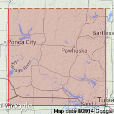
Named from good exposures on the headwaters of Cochahee Creek in the southwestern part of T25N, R10E, Osage Reservation, Osage Co, OK on the Chautauqua platform. Is very well exposed near Nelagoney where it forms a rim capping the hill where the town was built; also seen as a well-defined ledge on hill slopes overlooking Saucy Calf Creek just northwest of Nelagoney where it is less than 3 ft thick. At other places, is 10 to 25 ft thick. Consists of a thin, flaggy bed of sandstone which is massive, hard, and fossiliferous. Has a peculiar weathered surface suggesting turkey tracks; this surface and the fossil, FUSULINA, are its most characteristic features. Lies about 45 ft above the Labadie limestone and 125 ft below the Oread limestone. Stratigraphic sections. Of upper [Late] Pennsylvanian age.
Source: GNU records (USGS DDS-6; Denver GNULEX).
For more information, please contact Nancy Stamm, Geologic Names Committee Secretary.
Asterisk (*) indicates published by U.S. Geological Survey authors.
"No current usage" (†) implies that a name has been abandoned or has fallen into disuse. Former usage and, if known, replacement name given in parentheses ( ).
Slash (/) indicates name conflicts with nomenclatural guidelines (CSN, 1933; ACSN, 1961, 1970; NACSN, 1983, 2005, 2021). May be explained within brackets ([ ]).