- Usage in publication:
-
- Cobham Bay Member*
- Modifications:
-
- Named
- Biostratigraphic dating
- Geochronologic dating
- Dominant lithology:
-
- Sand
- Clay
- AAPG geologic province:
-
- Atlantic Coast basin
Summary:
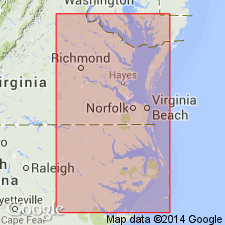
Named as a member of Eastover Formation of Chesapeake Group. Named for exposures along James River at Cobham Bay, southeastern VA. Consists of grayish-blue, (tan at type section), yellowish-orange-weathering, fine-grained, well-sorted shelly sand throughout most of its geographic extent. Some clay is present where structural or depositional barriers have formed. Thickness varies from 1.0 m near Murfreesboro, NC, to 3.6 m at Wilcox Lake in Petersburg and in Richmond, VA, to 12 m at Bayport on Rappahannock River in VA, to 3 m in St. Mary's Co., MD; thickness is 3.7 m at type section. Unconformably overlies Claremont Manor Member of Eastover Formation except at Murfreesboro, NC, and along Nottoway River near Littleton, Sussex Co., VA where it overlies Cretaceous sand and clay; underlies Yorktown Formation. Age is middle late Miocene (late Tortonian) based on radiometric age of 8.7+/-0.4 Ma for glauconite. Glauconite from shallow subsurface on eastern shore of VA yielded a date of 6.46+/-0.15 Ma (J.P. Owens, 1977, written commun.). While glauconite dates are not reliable, they are supported by presence of mollusk CHESAPECTEN MIDDLESEXENSIS, which is also in the bivalve ARCA zone of the Miocene in FL. Akers (1972) places the ARCA in planktonic foraminifer zone N17 (largely late Tortonian). Also contains ostracode AURELIA REDBAYENSIS in upper part of Cobham Bay and in ARCA zone (J.E. Hazel, 1975, written commun.).
Source: GNU records (USGS DDS-6; Reston GNULEX).
For more information, please contact Nancy Stamm, Geologic Names Committee Secretary.
Asterisk (*) indicates published by U.S. Geological Survey authors.
"No current usage" (†) implies that a name has been abandoned or has fallen into disuse. Former usage and, if known, replacement name given in parentheses ( ).
Slash (/) indicates name conflicts with nomenclatural guidelines (CSN, 1933; ACSN, 1961, 1970; NACSN, 1983, 2005, 2021). May be explained within brackets ([ ]).

