- Usage in publication:
-
- Coalbank Hill member
- Modifications:
-
- Original reference
- Dominant lithology:
-
- Mudstone
- Siltstone
- Breccia
- AAPG geologic province:
-
- San Juan Mountains province
Summary:
Pg. 2115 (fig. 4), 2116-2119. Coalbank Hill member of Molas formation. Basal member of formation. Includes red mudstones and siltstones containing solution-rounded limestone boulders and chert fragments and overlying structureless mudstones and siltstones. This is "transition zone" mentioned by earlier writers; the "rubble breccia" of upper Redwall and the "residual soil" in lower part of basal member of Naco (Huddle and Dobrovolny, 1952, USGS Prof. Paper 233-D); and lowest member of Molas as subdivided by Wengerd and Strickland (1954). Thickness about 56 feet at type locality [Coalbank Hill]; 13 feet at Stag Mesa; 5 feet at Ouray. Underlies middle unnamed member; unconformably overlies Leadville limestone. Where Leadville is absent, overlies Ouray limestone; contact appears gradational. No fossils. Age defined only by stratigraphic position, post-Leadville, pre-middle Molas. Mississippian-Pennsylvanian boundary probably contained within it or overlying member.
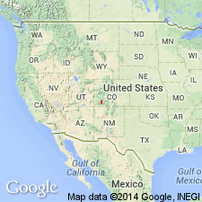
Type area: Coalbank Hill on U.S. Highway 550, 33 mi north of Durango, [San Juan Co.], southwestern CO.
Source: US geologic names lexicon (USGS Bull. 1200, p. 852).
For more information, please contact Nancy Stamm, Geologic Names Committee Secretary.
Asterisk (*) indicates published by U.S. Geological Survey authors.
"No current usage" (†) implies that a name has been abandoned or has fallen into disuse. Former usage and, if known, replacement name given in parentheses ( ).
Slash (/) indicates name conflicts with nomenclatural guidelines (CSN, 1933; ACSN, 1961, 1970; NACSN, 1983, 2005, 2021). May be explained within brackets ([ ]).

