

- Usage in publication:
-
- Coal Bluff series of sands and lignites
- Modifications:
-
- Original reference
- Dominant lithology:
-
- Sand
- Lignite
- Coal
- AAPG geologic province:
-
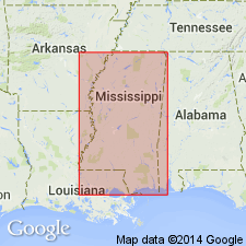
- Mid-Gulf Coast basin
Summary:
Pg. 421. Coal Bluff series of sands and lignites. Cross-bedded sands and sandy clays, 0 to 70 feet thick, including Coal Bluff lignite, 5 feet thick, at base. Is that portion of the Tertiary below Nanafalia group and above Coal Bluff lignite, inclusive. [Age is early Eocene.]
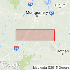
[Named from exposures on Alabama River at Coal Bluff, Wilcox Co., southern AL.]
Source: US geologic names lexicon (USGS Bull. 896, p. 471-472).
- Usage in publication:
-
- Coal Bluff beds
- Modifications:
-
- Revised
- AAPG geologic province:
-
- Mid-Gulf Coast basin
Summary:
Nanafalia formation is divisible into three phases based both on lithology and fossil content. Lowest of the three phases is referred to as Coal Bluff beds, and two upper phases as Gullette Bluff beds. Smith used term Coal Bluff to apply to lignite beds at base of Nanafalia. In present report name is extended to include all strata (42-70 ft) below Gullette Bluff beds.
Source: GNU records (USGS DDS-6; Reston GNULEX).

- Usage in publication:
-
- Coal Bluff series†
- Coal Bluff beds†
- Modifications:
-
- Abandoned
- AAPG geologic province:
-
- Mid-Gulf Coast basin
Summary:
†Coal Bluff series (†Coal Bluff beds) in Wilcox group. This term, as above defined [Langdon (1894)], restricted Nanafalia formation by separation, from its basal part, of these beds as well as the underlying lignite. The 1886 and 1892 uses of Nanafalia by E.A. Smith were Nanafalia and Coal Bluff section, in which these beds were included. The term "Coal Bluff" fell into disuse until 1920, when J.E. Brantly (Alabama Geol. Survey Bull., no. 22, p. 148-152) revived it, applying "Coal Bluff beds" to 42 to 77 feet of strata forming basal member of Nanafalia formation in Alabama and calling the rest of the Nanafalia the "Gullette Bluff beds." In 1932 C.W. Cooke extended Ackerman formation of Mississippi into Alabama to replace Coal Bluff beds and restricted Nanafalia formation to the beds above the †Coal Bluff. This is present approved definition of Nanafalia formation.
Source: US geologic names lexicon (USGS Bull. 896, p. 471-472).

- Usage in publication:
-
- Coal Bluff marl member
- Modifications:
-
- Revised
- AAPG geologic province:
-
- Mid-Gulf Coast basin
Summary:
Coal Bluff is allocated to member status in the Naheola formation. Deposits from which fauna was collected, have been considered previously as lower part of Coal Bluff beds of Langdon (1894) or Ackerman formation of Cooke (1933).
Source: GNU records (USGS DDS-6; Reston GNULEX).
- Usage in publication:
-
- Coal Bluff marl member*
- Modifications:
-
- Revised
- AAPG geologic province:
-
- Mid-Gulf Coast basin
Summary:
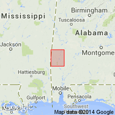
Name Coal Bluff marl member is restricted to glauconitic sandy marls and shales of Brantly (1920). Upper coarse sands are of Wilcox age. Thickness varies, probably averaging 35 ft. Present at top of Naheola formation. Traced from western Butler Co. west to eastern Choctaw Co., beyond which it becomes nonfossiliferous and cannot be differentiated from rest of Naheola.
Source: GNU records (USGS DDS-6; Reston GNULEX).
- Usage in publication:
-
- Coal Bluff member
- Modifications:
-
- Overview
- AAPG geologic province:
-
- Mid-Gulf Coast basin
Summary:
Member described in Choctaw Co. where it consists of fine- to medium-grained marine sand and thin platy limonite zones. Disconformably overlies lignite at top of Oak Hill member (new). Unconformable with overlying glauconitic sand and marl of Nanafalia formation of Wilcox group or with gravelly basal sand member of Nanafalia where it is present. Thickness about 60 ft.
Source: GNU records (USGS DDS-6; Reston GNULEX).
- Usage in publication:
-
- Coal Bluff formation
- Modifications:
-
- Revised
- AAPG geologic province:
-
- Mid-Gulf Coast basin
Summary:
Coal Bluff formation of Wilcox group, consists of lower glauconitic and upper nonglauconitic members. Overlies Naheola formation; underlies Nanafalia formation.
Source: GNU records (USGS DDS-6; Reston GNULEX).
- Usage in publication:
-
- Coal Bluff marl member
- Modifications:
-
- Revised
- AAPG geologic province:
-
- Mid-Gulf Coast basin
Summary:
Term "Coal Bluff Section" was used by Smith (1896, AL Geol. Survey Bull. 1) and "Coal Bluff beds" was used by Brantly (1920) to designate 40 to 70 ft of glauconitic sand, cross-bedded sand, and laminated clay and sandy clay that overlie Oak Hill member. Lignite at bottom of the Coal Bluff beds is now included in Oak Hill member and a bed 20 ft or more thick, of yellow to white cross-bedded sand with clay pebbles 10 to 40 ft above the lignite bed is now included in Nanafalia formation as Gravel Creek sand member (new). The intervening beds make up Paleocene Coal Bluff marl member.
Source: GNU records (USGS DDS-6; Reston GNULEX).

- Usage in publication:
-
- Coal Bluff Member
- Modifications:
-
- Overview
- AAPG geologic province:
-
- Mid-Gulf Coast basin
Summary:
Naheola Formation of Midway Group is divided into the Oak Hill Member below and the Coal Bluff Marl Member above according to AL State usage. The Coal Bluff consists of glauconitic partly fossiliferous sand and fossiliferous sandy marl and contains thin-bedded silty clay in the upper part. Unconformably underlies Gravel Creek Sand Member of Nanafalia Formation. The Coal Bluff is 15 to 60 ft thick, is absent in eastern AL and is unfossiliferous and not distinguished as separate member in Sumter Co. and to the west in MS. Age is Paleocene (lower Thanetian).
Source: GNU records (USGS DDS-6; Reston GNULEX).
For more information, please contact Nancy Stamm, Geologic Names Committee Secretary.
Asterisk (*) indicates published by U.S. Geological Survey authors.
"No current usage" (†) implies that a name has been abandoned or has fallen into disuse. Former usage and, if known, replacement name given in parentheses ( ).
Slash (/) indicates name conflicts with nomenclatural guidelines (CSN, 1933; ACSN, 1961, 1970; NACSN, 1983, 2005, 2021). May be explained within brackets ([ ]).