The National Geologic Map Database is migrating to a new infrastructure. We apologize for any service disruptions during this process.
|
|---|


- Usage in publication:
-
- Clipper Ridge Member*
- Modifications:
-
- Named
- Dominant lithology:
-
- Quartzite
- Sandstone
- Limestone
- AAPG geologic province:
-
- Great Basin province
Summary:
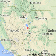
Named as basal member of Bingham Mine Formation (new), upper formation of Oquirrh Group (rank raised) for exposures on south side of Clipper Ridge in Middle Canyon on west side Oquirrh Mountains. Is part of Bingham sequence. Is 2,985 ft thick at its type section, designated and measured in N1/2 sec 6, T4S, R3W and S1/2 sec 31, T3S, R3W, Bingham Canyon quad, Tooele Co, UT in Great Basin province. Conformably overlies Butterfield Peaks Formation (new) of Oquirrh. Conformably underlies Markham Peak Member (new) of Bingham Mine Formation. Lower contact placed at base of a 10 ft quartzite that underlies the Jordan marker bed, a 361 ft gray arenaceous limestone interbedded with cherty limestone, silty limestone, and calcareous sandstone. Consists of orthoquartzite, calcareous quartzite, and calcareous and quartzose sandstone, and also has several limestone layers more than 100 ft thick. Quartzite can be medium to thick bedded, fine to medium grained, and some beds are finely banded, some are cross-bedded. Limestones are thinner in upper part. Fossils sparse and poorly preserved. Corals and Missourian-age fusulinids (listed). Of Late Pennsylvanian, Missouri age. Columnar sections. Correlation chart.
Source: GNU records (USGS DDS-6; Denver GNULEX).
For more information, please contact Nancy Stamm, Geologic Names Committee Secretary.
Asterisk (*) indicates published by U.S. Geological Survey authors.
"No current usage" (†) implies that a name has been abandoned or has fallen into disuse. Former usage and, if known, replacement name given in parentheses ( ).
Slash (/) indicates name conflicts with nomenclatural guidelines (CSN, 1933; ACSN, 1961, 1970; NACSN, 1983, 2005, 2021). May be explained within brackets ([ ]).