The National Geologic Map Database is migrating to a new infrastructure. We apologize for any service disruptions during this process.
|
|---|


- Usage in publication:
-
- Cliff House sandstone*
- Modifications:
-
- Named
- Dominant lithology:
-
- Sandstone
- AAPG geologic province:
-
- Paradox basin
Summary:
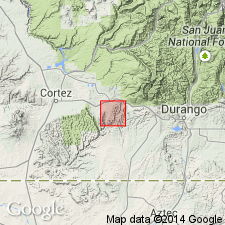
Named as upper formation of Mesaverde group (raised in stratigraphic rank) for exposures in canyons about the cliff houses of Mesa Verde National Park, Montezuma Co, CO, in Paradox basin. No type locality designated. Same unit was called "Upper Escarpment" in earlier reports. Is composed of hard, prominent to friable sandstone. About 400 ft thick is exposed. Overlies Menefee formation (new name) of Mesaverde. Assigned to the Late Cretaceous.
Source: GNU records (USGS DDS-6; Denver GNULEX).
- Usage in publication:
-
- Cliff House sandstone*
- Modifications:
-
- Revised
- AAPG geologic province:
-
- San Juan basin
Summary:
Is the upper formation of the Upper Cretaceous Mesaverde group above the Menefee formation of the Mesaverde and beneath the Lewis shale. Composed of white to orange, fine-grained, calcareous sandstone that intertongues with the underlying Menefee and the overlying Lewis. Three sandstone tongues distinguishable at base of formation are named Beechatuda, Cholla Canyon, and Barker Dome tongues. These tongues show a 90 southeastward rise of the base of the Cliff House. An upper tongue named the Ute Canyon tongue. All of the tongues have a limited areal extent. Geologic map. Cross section. Of Late Cretaceous age.
Source: GNU records (USGS DDS-6; Denver GNULEX).
- Usage in publication:
-
- Cliff House sandstone*
- Modifications:
-
- Revised
- AAPG geologic province:
-
- San Juan basin
Summary:
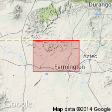
Is fifth formation from base of six formations of Upper Cretaceous Mesaverde group in southern San Juan basin. Mesaverde raised to group rank and used throughout San Juan basin of southwest CO and northwest NM. Overlies Allison member of Menefee formation; underlies and intertongues with Lewis shale. Where Lewis has pinched out (for example, southeast of Newcomb in southwest San Juan Co), Cliff House and Pictured Cliffs (usually above Lewis) form an undivided sandstone body. Where Lewis is missing, the name Pictured Cliffs sandstone is applied to entire sandstone body because l) of its long history of usage, 2) it represents the closing stages of marine deposition in the basin, 3) it is separated from Mesaverde in the subsurface, and 4) it intertongues with Lewis shale and with Fruitland formation. A sandstone unit in the eastern part of the basin near La Ventana is designated La Ventana tongue of Cliff House. La Ventana does not connect with Mesaverde, but is thought to connect with main body of Cliff House "somewhere in the subsurface" because Cliff House and La Ventana are genetically related transgressive marine sandstones in upper Mesaverde. Simplified geologic map. Diagrammatic cross section.
Source: GNU records (USGS DDS-6; Denver GNULEX).
- Usage in publication:
-
- Cliff House Sandstone*
- Modifications:
-
- Areal extent
- Mapped 1:50k
- Dominant lithology:
-
- Sandstone
- Shale
- AAPG geologic province:
-
- San Juan basin
Summary:
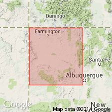
Is Upper Cretaceous formation mapped as two units in San Juan and McKinley Cos, NM (San Juan basin). Main body is white to dark-yellowish-orange, thin- to thick-bedded, fine- to coarse-grained, lenticular and cross-bedded or massive sandstone. Contains gray or brown carbonaceous shale lenses. Forms high bold cliffs and ridges. Mapped as Chacra Sandstone Member (name now abandoned) of Mesaverde Formation by Dane (1936). Intertongues with both Lewis Shale and Menefee Formation. Contains casts of the burrows of OPHIOMORPHA MAJOR, indicative of a nearshore marine environment, and marine fossil invertebrates. Is as much as 430 ft thick. Upper bed (separately mapped) is brown and yellowish-gray, massive sandstone; commonly capped by a dark-brown sandstone about 2 ft thick, which contains abundant broken bits of marine fossil invertebrates. Forms conspicuous ledge that is everywhere separated by a tongue of the Menefee Formation from underlying parts of the Cliff House. Is as much as 55 ft thick. Thins and grades northward into Lewis Shale at localities to the northwest of report area.
Source: GNU records (USGS DDS-6; Denver GNULEX).
- Usage in publication:
-
- Cliff House Sandstone*
- Modifications:
-
- Areal extent
- AAPG geologic province:
-
- San Juan basin
Summary:
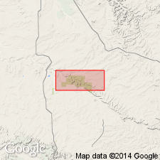
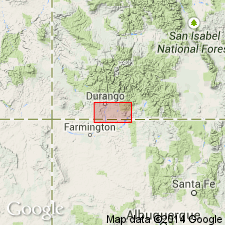
Mapped as the upper formation of the Upper Cretaceous Mesaverde Group on five cross sections of the subsurface of southern La Plata Co, CO and northern San Juan Co, NM in the San Juan basin. Is poorly developed in report area. Extent in CO on these sections is limited to the southern tier of townships (Ts32 and 33N) and ranges (Rs7 to 12W). An outlier of Cliff House identified north of town of Ignacio and southeast of Durango in La Plata Co between Ts33 to 35N and Rs6 to 8W. Tongues out into Menefee Formation of Mesaverde Group south of sec 2, T33N, R7W and into Lewis Shale north of secs 24 and 26, T33N, R7W.
Source: GNU records (USGS DDS-6; Denver GNULEX).
For more information, please contact Nancy Stamm, Geologic Names Committee Secretary.
Asterisk (*) indicates published by U.S. Geological Survey authors.
"No current usage" (†) implies that a name has been abandoned or has fallen into disuse. Former usage and, if known, replacement name given in parentheses ( ).
Slash (/) indicates name conflicts with nomenclatural guidelines (CSN, 1933; ACSN, 1961, 1970; NACSN, 1983, 2005, 2021). May be explained within brackets ([ ]).