The National Geologic Map Database is migrating to a new infrastructure. We apologize for any service disruptions during this process.
|
|---|


- Usage in publication:
-
- Click series
- Modifications:
-
- Original reference
- AAPG geologic province:
-
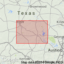
- Llano uplift
Summary:
Pl. 3, p. ivii, 274. Click series. Metamorphosed calcareous rock or dolomitic marble, overlying Iron Mountain series and forming top division of Fernandan system. [Age is pre-Cambrian (Llano).]
[Probably named from Click, Llano Co., central TX.]
Source: US geologic names lexicon (USGS Bull. 896, p. 462).

- Usage in publication:
-
- Click series†
- Modifications:
-
- Abandoned
- AAPG geologic province:
-
- Llano uplift
Summary:
†Click series abandoned. Part of Packsaddle schist of modern nomenclature.
Source: US geologic names lexicon (USGS Bull. 896, p. 462).
- Usage in publication:
-
- Click Member
- Modifications:
-
- Reinstated
- AAPG geologic province:
-
- Llano uplift
Summary:
Pg. 2870. Click Member of Packsaddle Formation. Uppermost member of formation. Overlies Rough Ridge Member (new). Age is Precambrian.
Recognized in southeastern Llano uplift, central TX.
Source: US geologic names lexicon (USGS Bull. 1350, p. 159).
- Usage in publication:
-
- Click Formation
- Modifications:
-
- Principal reference
- Revised
- Dominant lithology:
-
- Schist
- Leptite
- AAPG geologic province:
-
- Llano uplift
Summary:
Pg. 10, pl. 1. Click Formation of Packsaddle Group of Llano Supergroup. Uppermost formation of the Packsaddle. Consists of (ascending): (1) lower part (exposed at type section), light-brown to pink leptite and quartz-feldspar schist with a greenish-gray actinolite schist at base, 3,410 feet (1,040 m) thick; and (2) upper part, mostly hornblende schist, about 3,800 feet (1,155 m) thick. At type section, upper part of formation is cut off by the Big Branch Gneiss (an orthogneiss). Overlies Rough Ridge Formation of Packsaddle Group. Age is Precambrian.
Type section (lower part): on the J.L. Pearson Ranch, about 1 mi (1.6 km) southwest of Click, Click quadrangle, Llano Co., central TX.
Source: Publication.
- Usage in publication:
-
- Click Formation
- Modifications:
-
- Mapped 1:500k
- AAPG geologic province:
-
- Llano uplift
Summary:
Click Formation of Packsaddle Schist [Click Formation of Packsaddle Group]. Mostly hornblende schist, underlain by leptite and quartz-feldspar-mica schist, which grades into hornblende schist southeastward; green actinolite schist at base grades to mica schist and hornblende schist toward southeast; thickness about 7.200 feet. Age is Precambrian.
Notable exposures around where Llano, Gillespie, and Blanco Cos. meet, central TX.
[The Click Formation of Packsaddle Schist is an invalid hierarchy. Formations cannot include other formations (CSN, 1933; ACSN, 1961, 1970; NACSN, 1983, 2005, 2021).]
Source: Publication.
For more information, please contact Nancy Stamm, Geologic Names Committee Secretary.
Asterisk (*) indicates published by U.S. Geological Survey authors.
"No current usage" (†) implies that a name has been abandoned or has fallen into disuse. Former usage and, if known, replacement name given in parentheses ( ).
Slash (/) indicates name conflicts with nomenclatural guidelines (CSN, 1933; ACSN, 1961, 1970; NACSN, 1983, 2005, 2021). May be explained within brackets ([ ]).