

- Usage in publication:
-
- Clear Creek Tuff Member
- Modifications:
-
- Named
- Dominant lithology:
-
- Tuff
- AAPG geologic province:
-
- Wasatch uplift
- Great Basin province
Summary:
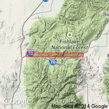
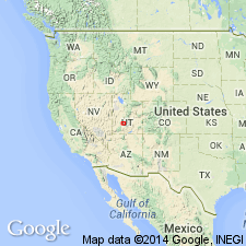
Named as a member of Dry Hollow Formation presumably, though not specifically stated, for exposures along Clear Creek west of Cove Fort, Sevier Co, UT on Wasatch uplift, and Millard Co, UT, Great Basin province. No type locality designated. Three divisions or units recognized. Lower unit is a 70-100 m thick single ash-flow cooling unit, a cliff-former, red in color due to post-depositional hematite staining. Feldspar makes up the most abundant phenocrysts, though large biotite, hornblende, and quartz phenocrysts visible in hand specimen. Middle unit is composed of three ash-flow tuff cooling units that total 100 m thick, have fewer phenocrysts by 10-20 percent than lower unit, and is identifiable by its high percentage of xenolith inclusions, some up to 30 cm in size. The groundmass is normally white, ashy, and loosely indurated. Middle unit is persistent across map area. Upper unit, found only in northern part of map area, is an ash-flow cooling unit never less than 50 m thick that is dominated by euhedral feldspar phenocrysts several mm in size. Has conspicuous hornblende and biotite, and up to 10 percent quartz. Magnetic direction of upper unit is reversed. Overlies Wales Canyon Tuff Member (new) of Dry Hollow. Underlies upper part of Dry Hollow. Of Miocene age. Geologic map.
Source: GNU records (USGS DDS-6; Denver GNULEX).
- Usage in publication:
-
- Clear Creek Tuff Member
- Modifications:
-
- Not used
Summary:
Assigned as a member of Dry Hollow Formation (abandoned). Preempted by prior use as a geologic name. Replaced by name Three Creeks Tuff Member of Bullion Canyon Volcanics. Not used in Wasatch uplift or Great Basin province, the areas of this report.
Source: GNU records (USGS DDS-6; Denver GNULEX).
For more information, please contact Nancy Stamm, Geologic Names Committee Secretary.
Asterisk (*) indicates published by U.S. Geological Survey authors.
"No current usage" (†) implies that a name has been abandoned or has fallen into disuse. Former usage and, if known, replacement name given in parentheses ( ).
Slash (/) indicates name conflicts with nomenclatural guidelines (CSN, 1933; ACSN, 1961, 1970; NACSN, 1983, 2005, 2021). May be explained within brackets ([ ]).