- Usage in publication:
-
- Clear Branch sandstone*
- Modifications:
-
- Named
- Dominant lithology:
-
- Sandstone
- Chert
- AAPG geologic province:
-
- Appalachian basin
Summary:
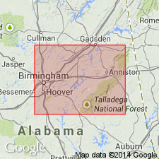
Named for Clear Branch Gap, Jefferson Co., north-central AL. Includes rocks previously part of Frog Mountain sandstone (here restricted in use). At Clear Branch Gap, consists of (descending) a 4-in.-thick quartz lens crowded with manganese-oxide-stained brachiopods, a 4-in.-thick lens of black chert, and 5 ft of sandstone with fine quartz pebbles. Overlain by 1.5 ft of green (Chattanooga?) shale; underlain by pebbles, probably belonging to Red Mountain formation. May extend northward towards Birmingham, but no fossils were found in sandstone of that area that occupies same stratigraphic position as Clear Branch sandstone. The 50 ft of sandstone in cuts of Alabama Great Southern Railroad about 2 mi from Vance, Tuscaloosa Co., is also believed to be of Oriskany age and part of Clear Branch sandstone. Beds of Oriskany age in AL are likely confined to southwestern end of Appalachian Valley from Tuscaloosa Co. to Chilton Co. and do not extend northeast of present margin of Coastal Plain.
Source: GNU records (USGS DDS-6; Reston GNULEX).
For more information, please contact Nancy Stamm, Geologic Names Committee Secretary.
Asterisk (*) indicates published by U.S. Geological Survey authors.
"No current usage" (†) implies that a name has been abandoned or has fallen into disuse. Former usage and, if known, replacement name given in parentheses ( ).
Slash (/) indicates name conflicts with nomenclatural guidelines (CSN, 1933; ACSN, 1961, 1970; NACSN, 1983, 2005, 2021). May be explained within brackets ([ ]).

