

- Usage in publication:
-
- Claytonville dolomite
- Modifications:
-
- Original reference
- Dominant lithology:
-
- Dolomite
- AAPG geologic province:
-
- Permian basin
Summary:
Pg. 26, pl. 1. Claytonville dolomite of Double Mountain group. White to gray dolomite, 1 to 3 feet thick. Usually underlain by red sandstone and followed by red shale and gypsum. The name Sweetwater, formerly used for this dolomite, is preoccupied. Lies near top of Double Mountain group. Age is Permian.
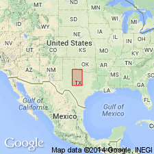
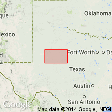
Type locality: caps escarpment 2 mi west of Sweetwater, Nolan Co., central northern TX, also at town of Claytonville, Fisher Co., central northern TX.
Source: US geologic names lexicon (USGS Bull. 896, p. 456-457).
- Usage in publication:
-
- Claytonville Dolomite
- Modifications:
-
- Areal extent
- AAPG geologic province:
-
- Permian basin
Summary:
Area of report is central TX; in this area the Whitehorse Sandstone and Cloud Chief Gypsum are mapped undivided. Separately mapped units of Whitehorse and Cloud Chief include (ascending): Childress Dolomite, Eskota Gypsum, and Claytonville Dolomite. Claytonville Dolomite is present in southern Stonewall Co, TX. Whitehorse, Cloud Chief, and Blaine (undivided) overlie Permian San Angelo Formation and underlie Permian Quartermaster Formation. Assigned to the Permian. Geologic map.
Source: GNU records (USGS DDS-6; Denver GNULEX).

- Usage in publication:
-
- Claytonville Dolomite
- Modifications:
-
- Mapped 1:250k
- Dominant lithology:
-
- Dolomite
- AAPG geologic province:
-
- Permian basin
Summary:
Is Permian unit [unranked; member?] mapped at top of undivided map unit comprised of Permian Whitehorse Sandstone and Cloud Chief Gypsum as mapped in mostly continuous north-south trending belt east of Caprock Escarpment in east-central part of map sheet. Claytonville is separately mapped in southeast Motley Co, TX (Palo Duro basin) and in eastern Dickens, northwest King, and central and eastern Kent Cos, TX (northeastern Permian basin). Overlain by Quartermaster Formation (Permian). Claytonville is not described separately. Undivided map unit described as sandstone, sand, shale, gypsum, and dolomite, interbedded. Sand and sandstone, fine-grained quartz, silty thin-bedded to massive, friable, orange brown, various shades of red mottled grayish green. Shale, sandy in part, indistinctly bedded to massive, red. Gypsum, massive, in part banded, beds up to 12 ft thick, white, pink. Dolomite, thin, discontinuous beds associated with gypsum, gray; units separately mapped include Claytonville Dolomite, at top, Eskota Gypsum, and Childress Dolomite, at base; Childress Dolomite forms scarp. Marine megafossils scarce. Thickness of undivided map unit 650+/-ft. Thickness of Claytonville is not given.
Source: GNU records (USGS DDS-6; Denver GNULEX).
For more information, please contact Nancy Stamm, Geologic Names Committee Secretary.
Asterisk (*) indicates published by U.S. Geological Survey authors.
"No current usage" (†) implies that a name has been abandoned or has fallen into disuse. Former usage and, if known, replacement name given in parentheses ( ).
Slash (/) indicates name conflicts with nomenclatural guidelines (CSN, 1933; ACSN, 1961, 1970; NACSN, 1983, 2005, 2021). May be explained within brackets ([ ]).