- Usage in publication:
-
- Claron limestone*
- Modifications:
-
- First used
- Dominant lithology:
-
- Limestone
- Sandstone
- Conglomerate
- AAPG geologic province:
-
- Great Basin province
Summary:
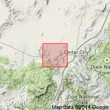
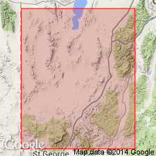
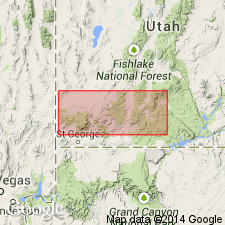
First published use of name. Intent to name, source of geographic name, and type locality not designated. Extensive exposures mapped at Mount Claron in the south-central part of quad, near Joel Springs and Chloride Canyons at the west-central part of the quad, and in the northeast part of quad near Eightmile Pass and north of Iron Springs Creek. Mapped area is in Iron Co, UT in the Great Basin province. Is mainly sandy limestone that varies from white and gray to pink, red, and purple. Spherical and irregular cherty concretions one-half to more than one inch in diameter present in some layers. Yellow-brown, heavy sandstone with discontinuous conglomerate layers interbedded with the limestone. Difficult to distinguish from Cretaceous sandstone at some localities. Averages 1,000 ft thick. Is younger than the Jurassic and Cretaceous Pinto sandstone (first used). Overlain by Tertiary lavas. Fossils (brachiopods, crinoid stems, bryozoans, corals) found in limestone and in chert pebbles. Geologic map. Shown as Eocene age.
Source: GNU records (USGS DDS-6; Denver GNULEX).
- Usage in publication:
-
- Claron formation
- Modifications:
-
- Revised
- AAPG geologic province:
-
- Great Basin province
Summary:
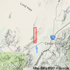
Name applied to a 1,000 ft thick coarse boulder conglomerate, gray and red sandstone, and white to pink limestone considered identical to Wasatch formation of Colorado Plateau area. Unconformably overlies the newly named Iron Springs formation (formerly called Pinto sandstone). Overlain by Quaternary deposits. Geologic map of parts of the district, Iron Co., UT in the Great Basin province. Cross sections. Assigned to the Late Cretaceous or Eocene, or both. [A Paleocene age not considered.]
Source: GNU records (USGS DDS-6; Denver GNULEX).
- Usage in publication:
-
- Claron formation*
- Modifications:
-
- Age modified
- AAPG geologic province:
-
- Great Basin province
Summary:
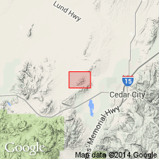
Age modified from Eocene to Eocene? [no explanation included]. Thought to be equivalent to the Wasatch formation. Overlies the Upper? Cretaceous Iron Springs formation which was unnamed and a part of the Pinto sandstone of Leith and Harder (1908). Is older than unnamed volcanic (quartz latite porphyry) rocks. Mapped (geologic map) in the southeast central part of the area, Iron Co, UT in the Great Basin province. Divisible into members A (oldest) to E (youngest). Is about 1,400 ft thick in the Granite Mountain area in the central part of the quad, and 1,500 ft thick elsewhere in quad.
Source: GNU records (USGS DDS-6; Denver GNULEX).
- Usage in publication:
-
- Claron formation
- Modifications:
-
- Revised
- Overview
- AAPG geologic province:
-
- Great Basin province
Summary:
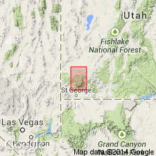
Revised in that Claron disconformably underlies newly named Quichapa group in area of Pine Valley Mountains, Washington and Iron Cos, UT, Great Basin province. Unconformably overlies Kaiparowits formation. Thickness ranges up to 1000 ft and averages 500 ft. Geologic map; measured sections; cross sections. Tentatively assigned late Late Cretaceous (Laramian) to Eocene age.
Source: GNU records (USGS DDS-6; Denver GNULEX).
- Usage in publication:
-
- Claron formation
- Modifications:
-
- Contact revised
- AAPG geologic province:
-
- Great Basin province
Summary:
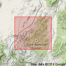
Upper contact revised in that Claron underlies the newly named Wah Wah Springs tuff [member] of the newly named Needles Range formation. Historical usage discussed. Eocene age. Report area is in southwest UT in the Great Basin province.
Source: GNU records (USGS DDS-6; Denver GNULEX).
- Usage in publication:
-
- Claron Formation*
- Modifications:
-
- Not used
Summary:
Not used in this report adjacent to but east of the High Plateaus of southern UT in Paradox basin. Beds formerly assigned to Claron now called Upper Cretaceous and Paleocene? Canaan Peak Formation (new name), Paleocene? Pine Hollow Formation, and the Paleocene and lower Eocene pink limestone member and lower or middle Eocene white limestone member of the Wasatch Formation.
Source: GNU records (USGS DDS-6; Denver GNULEX).
- Usage in publication:
-
- Claron Formation*
- Modifications:
-
- Overview
- Age modified
- AAPG geologic province:
-
- Great Basin province
- Wasatch uplift
Summary:
History of usage described. Claron on the southwestern High Plateaus, UT, Wasatch uplift and Great Basin province, is divisible into lower red and upper white members. Correlation chart; cross sections. The red member has a basal conglomerate overlain by red and red-stained limestone, sandstone, and conglomerate, and is 300 to 400+ ft thick. The white member consists of white to light-gray sandstone, tuffaceous sandstone, limestone, and conglomerate 100 to nearly 350 ft thick. The boundary between the two members is gradational and at some places is placed at the base of a conspicuous massive resistant white limestone. Unconformably overlies Upper Cretaceous and older rocks. Is overlain by Needles Range Formation; upper boundary placed at base of lowest lava flow, breccia, or ash-flow tuff. Lateral extent not fully known. Basal conglomerate may be equivalent to part of Canaan Peak Formation, and the remaining part to the pink limestone, white limestone and variegated sandstone members of the Wasatch Formation of southern UT. Other correlations suggested. Age modified from Eocene? to Eocene and Oligocene. Basal strata may be as old as latest Cretaceous? or Paleocene?. A K-Ar date of 31.1 +/-0.5 m.y. obtained from a local crystal-poor ash-flow tuff above the Claron. Is interbedded with rocks of the early eruptive phase of Needles Range Formation.
Source: GNU records (USGS DDS-6; Denver GNULEX).
- Usage in publication:
-
- Claron Formation
- Modifications:
-
- Revised
- AAPG geologic province:
-
- Great Basin province
- Paradox basin
Summary:
Revised in that unit underlies the reinstated Brian Head Formation. Study area is on Markagunt Plateau, Iron and Garfield Cos, UT, Great Basin province and Paradox basin. Assigned Paleocene and Eocene age.
Source: GNU records (USGS DDS-6; Denver GNULEX).
- Usage in publication:
-
- Claron Formation*
- Modifications:
-
- Age modified
- Mapped 1:24k (Paragonah quad, Iron Co, UT)
- Dominant lithology:
-
- Sandstone
- Mudstone
- Limestone
- Conglomerate
- AAPG geologic province:
-
- Great Basin province
Summary:
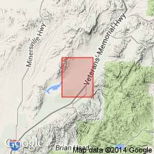
Mapped in southeast corner of quad, Iron Co, UT, Great Basin province. Mapped as slightly to moderately resistant fluvial and lacustrine deposits of intercalated sandstone, mudstone, limestone, and conglomerate beds. Unit is mottled and varicolored. Equivalent to "pink" subunit of Claron of Doelling and others (1989, Utah Geological and Min. Survey Bull. 124). Maximum exposed thickness is 45 m. Unconformably(?) overlies Paleocene conglomerate of Parowan Gap; unconformably(?) underlies Oligocene sedimentary and volcanic rocks of Red Hills. Age as mapped in this study is Eocene and Paleocene(?); however, basal beds may be latest Cretaceous.
Source: GNU records (USGS DDS-6; Denver GNULEX).
- Usage in publication:
-
- Claron Formation*
- Modifications:
-
- Age modified
- Revised
- AAPG geologic province:
-
- Great Basin province
- Paradox basin
Summary:
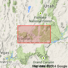
Unit occurs throughout study area in southwest UT where Claron ranges in thickness from 165 m in Beaver Dam Mountains, Washington Co, Great Basin province to 640 m in Table Cliff Plateau region, Garfield Co, Paradox basin. As much as 230 m of boulder-to-pebble conglomerate and sandstone previously mapped as basal part of Claron and upper part of Canaan Peak Formation is assigned to informal "Grand Castle formation." General geologic map. Age of Claron from stratigraphic chart (fig. 3) shown to be late Paleocene to Oligocene in Parowan area [there is no discussion of Oligocene age in report] and middle and late Eocene at Table Cliff Plateau. Author states that age ranges from Paleocene to late Eocene(?) [Author may have meant late(?) Eocene.] Basis for age includes: 1) Gastropods VIVIPARUS TROCHIFORMIS, GONIOBASIS sp., and PHYSA sp. (J.G. Eaton, 1990, written commun.) collected from Claron are also present in Paleocene and Eocene Flagstaff Formation of central UT. 2) Palynomorphs from basal Claron in Pine Valley Mountains indicate a late Paleocene age (Goldstrand, 1991, unpub. PhD dissert., Univ. Nev., Reno). 3) A tentative middle Eocene fission-track age on upper part of underlying Pine Hollow Formation on Table Cliff Plateau suggests that basal Claron may be no older than middle Eocene. 4) Preliminary mammalian fossil ages from an overlying mudstone unit northwest of Table Cliff Plateau indicate that upper Claron is no younger than latest Eocene (J.G. Eaton, 1992, personal commun.).
Source: GNU records (USGS DDS-6; Denver GNULEX).
- Usage in publication:
-
- Claron Formation*
- Modifications:
-
- Overview
- AAPG geologic province:
-
- Great Basin province
Summary:
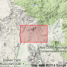
Mapped in southwest UT, Great Basin province. Divided into lower, middle, and upper members each separately mapped. Lower member is white sandstone and orange conglomerate intermittently exposed along north edge of Motoqua and Gunlock quads from Beaver Dam Wash on the west to Grapevine Wash on the east; ranges up to 100 m thick near Jackson Wash. Middle member is maroon mudstone interbedded with mottled grayish-purple and yellowish-gray limestone and pinkish- or purplish-gray conglomeratic sandstone lenses; about 47 m thick at Grapevine Wash. Upper member is thinly laminated to thick-bedded light-gray limestone and includes stromatolites, laminated algal structures, and drop-pebbles in places; generally 10 m thick ranging up to 25 m. In western exposures lower member unconformably overlies upper Paleozoic Pakoon and Callville Limestones and from White Rocks eastward unconformably overlies Cretaceous? and Tertiary? Grapevine Wash Formation with angular discordance. Underlies Wah Wah Springs Tuff of Needles Range Group. Age discussed; may be Paleocene by analogy with Flagstaff Limestone of north-central UT which occupies similar tectono-stratigraphic position or it may be entirely Oligocene deposited in local lake basins preceding Needles Range volcanism. As there is no definitive evidence to the contrary, Claron is assigned the generally accepted age of Eocene and Oligocene.
Source: GNU records (USGS DDS-6; Denver GNULEX).
- Usage in publication:
-
- Claron Formation*
- Modifications:
-
- Overview
- AAPG geologic province:
-
- Paradox basin
- Wasatch uplift
- Great Basin province
Summary:
Represents oldest Tertiary unit in Marysvale volcanic field which is located in west-central UT in Paradox basin, Wasatch uplift, and Great Basin province. Recent and ongoing studies by other workers has locally modified upper and lower boundaries of Claron. Age of Claron is poorly constrained. Goldstrand (1990, Utah Geol. and Min. Survey Misc. Pub. 90-2) reported that palynomorph fossils from basal Claron from eastern Pine Valley Mountains indicate a late Paleocene age, however, a fission-track date of 50 +-6 Ma (Eocene) was determined from rocks just below Claron in Table Cliff Plateau. Goldstrand also found gastropod fossils in lower part of Claron resembling those collected from Paleocene to Eocene Flagstaff Formation in central UT. Authors assign a late Paleocene to Oligocene age to Claron as it is currently used. However, current studies of Claron may restrict its age. Regionally, age of upper parts of Claron and overlying Brian Head Formation is constrained by overlying Wah Wah Springs Formation which has been dated at 29.5 Ma (Oligocene). Composite stratigraphic column.
Source: GNU records (USGS DDS-6; Denver GNULEX).
- Usage in publication:
-
- Claron Formation*
- Modifications:
-
- Revised
- AAPG geologic province:
-
- Great Basin province
Summary:
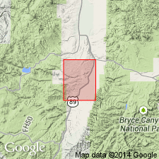
Basal part removed and assigned to newly named Grand Castle Formation in Markagunt Plateau and Parowan Gap areas of eastern Iron Co, UT, Great Basin province. Claron consists of fine-grained carbonate rock and calcareous sandstone and shale whereas Grand Castle consists of siliciclastic conglomerate and sandstone. Grand Castle-Claron contact is either gradational or abrupt; where gradational, contact is placed where red, calcareous sandstone and siltstone of Claron become dominant. Generalized geologic map. Stratigraphic chart.
Source: GNU records (USGS DDS-6; Denver GNULEX).
- Usage in publication:
-
- Claron Formation*
- Modifications:
-
- Revised
- AAPG geologic province:
-
- Paradox basin
Summary:
Upper contact revised in that some volcaniclastic fluvial lacustrine, and tuffaceous rocks formerly assigned to the upper part of the white member of the Claron Formation, on to an unnamed sequence above the white member, and beneath the Needles Range Group, in the Hatch quad and to west on the Markagunt Plateau, Garfield Co, UT, Paradox basin are named Limerock Canyon Formation. These newly named rock overlie white member of Claron and underlie Needles Range Group. Divided into a basal red member (Eocene and Paleocene) shown on cross section only, and upper white member (Eocene) mapped in southwest part of quad. Correlation chart.
Source: GNU records (USGS DDS-6; Denver GNULEX).
- Usage in publication:
-
- Claron Formation*
- Modifications:
-
- Overview
- AAPG geologic province:
-
- Great Basin province
Summary:
In study area of southwest UT, Great Basin province Oligocene Wah Wah Springs Formation generally rests on Claron but locally Wah Wah Springs is interbedded with upper part of Claron. Claron unconformably overlies Upper Cretaceous Iron Springs Formation. Composite stratigraphic column. Age stated to be late Paleocene to early Oligocene.
Source: GNU records (USGS DDS-6; Denver GNULEX).
For more information, please contact Nancy Stamm, Geologic Names Committee Secretary.
Asterisk (*) indicates published by U.S. Geological Survey authors.
"No current usage" (†) implies that a name has been abandoned or has fallen into disuse. Former usage and, if known, replacement name given in parentheses ( ).
Slash (/) indicates name conflicts with nomenclatural guidelines (CSN, 1933; ACSN, 1961, 1970; NACSN, 1983, 2005, 2021). May be explained within brackets ([ ]).

