

- Usage in publication:
-
- Clarksburg formation*
- Modifications:
-
- Named
- Dominant lithology:
-
- Schist
- AAPG geologic province:
-
- Lake Superior region
Summary:
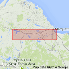
Is named as 1 of 3 formations in the Algonkian-age Upper Marquette series in the Marquette district (Lake Superior region). Is apparently named for exposures in the vicinity of Clarksburg, east-southeast of Michigamme Lake, western Marquette Co., MI. Is mapped (pl XIII) in east-west belt extending from an area north of Stoneville and extending west and north of Champion. Consists mainly of surface volcanics that vary from massive greenstones to volcanic conglomerates. The rocks comprise diorite-schists, hornblende-schists, biotite-hornblende-schists, and many peculiar rocks intermediate between fragmental slates and typical igneous phases.
Source: GNU records (USGS DDS-6; Denver GNULEX).
- Usage in publication:
-
- Clarksburg Volcanics Member*
- Modifications:
-
- Overview
- AAPG geologic province:
-
- Lake Superior region
Summary:
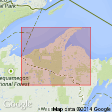
Pg. 2845 (fig. 2, stratigraphic chart compiled from Leith and others, 1935; James, 1958; Gair and Thaden, 1968). Clarksburg Volcanics Member of Michigamme Slate of Baraga Group of Marquette Range Supergroup (new; replaces †Animikie series of James, 1958, south of Lake Superior, in Michigan and Wisconsin). Present in Marquette Range, northwestern Michigan. Overlies Greenwood Iron-Formation Member and underlies Bijiki Iron-Formation Member, both of Michigamme Slate. Age is middle Precambrian.
Source: Publication.
- Usage in publication:
-
- Clarksburg Volcanics Member*
- Modifications:
-
- Overview
- AAPG geologic province:
-
- Lake Superior region
Summary:
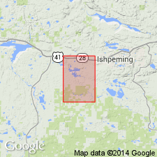
Is mapped as unit in lower part of Michigamme Formation in Baraga Group in Marquette Range Supergroup, Marquette Co, MI (Lake Superior region). Map unit described as mafic pyroclastic rocks with subordinate mafic flow rocks, argillaceous sedimentary rocks, iron-formation. Mostly buff-weathering, mafic pyroclastic rocks consisting of metatuff and meta-agglomerate in 0.5 to 1 ft layers. Commonly has rubbly appearance on weathered surfaces. Metatuff: fine-grained matrix of quartz, sericite, biotite, containing larger rock fragments, primarily mineral fragments (mostly plagioclase), and porphyroblasts; devitrified glass shards present in few rocks; plagioclase generally highly altered, in laths about 1 mm long, but as long as 1 cm locally common; primary mafic minerals totally destroyed by metamorphism. Meta-agglomerate: mineralogically similar to tuff; texturally similar except for inclusion of larger lithic fragments, as much as 1 ft diameter; fragments mostly tuff, pumice, scoraceous basalt; chert and granite fragments rare. Flow rock: known at only one locality near top of member; amygdular metabasalt with plagioclase laths about 0.5 mm long surrounded by very pale green chlorite; amygdules calcite or less commonly quartz. Argillite: thin units common and widespread but all too small to show at map scale; generally well laminated with beds a few inches thick and consisting of quartz, biotite, chlorite, sericite. Precambrian X.
Source: GNU records (USGS DDS-6; Denver GNULEX).
For more information, please contact Nancy Stamm, Geologic Names Committee Secretary.
Asterisk (*) indicates published by U.S. Geological Survey authors.
"No current usage" (†) implies that a name has been abandoned or has fallen into disuse. Former usage and, if known, replacement name given in parentheses ( ).
Slash (/) indicates name conflicts with nomenclatural guidelines (CSN, 1933; ACSN, 1961, 1970; NACSN, 1983, 2005, 2021). May be explained within brackets ([ ]).