

- Usage in publication:
-
- Clarks Ferry Member
- Modifications:
-
- Named
- Dominant lithology:
-
- Sandstone
- AAPG geologic province:
-
- Appalachian basin
Summary:
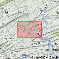
Named as a member in upper part Catskill Formation in Susquehanna group (redefined). Derivation of name not stated. Outcrops as a bench on north side of Peters Mountain east of Susquehanna River and Pine Ridge west of river. Consists of relatively resistant quartzitic sandstone. Thickness about 250 ft. Underlain and overlain by unnamed units in Catskill Formation. Age is Late Devonian.
Source: GNU records (USGS DDS-6; Reston GNULEX).
- Usage in publication:
-
- Clarks Ferry Member
- Modifications:
-
- Overview
- AAPG geologic province:
-
- Appalachian basin
Summary:
Author's purpose is to describe in detail the sedimentology of the Sherman Creek, Clarks Ferry and Duncannon Members of the upper part of the Catskill Formation as seen in three outcrops along Rte 322 in south-central PA. Outcrops are at Second Mountain, Peters Mountain, and Buffalo Mountain. All three members are composed of sandstone bodies and sandstone-mudstone interbeds and are recognized in part on the basis of the varying ratios of the two lithofacies associations. The Sherman Creek and Duncannon Members are composed of approximately equal amounts of sandstone and mudstone in the study area, while the Clarks Ferry is dominated by sandstone and is not as widespread. These three members are assigned to the alluvial plain depositional environment. Clarks Ferry is 21 m thick at Second Mountain and is composed entirely of sandstone. At Peters Mountain thickness increases to 59 m and sandstone percentage decreases to 90 percent. Unit is absent at Buffalo Mountain.
Source: GNU records (USGS DDS-6; Reston GNULEX).
For more information, please contact Nancy Stamm, Geologic Names Committee Secretary.
Asterisk (*) indicates published by U.S. Geological Survey authors.
"No current usage" (†) implies that a name has been abandoned or has fallen into disuse. Former usage and, if known, replacement name given in parentheses ( ).
Slash (/) indicates name conflicts with nomenclatural guidelines (CSN, 1933; ACSN, 1961, 1970; NACSN, 1983, 2005, 2021). May be explained within brackets ([ ]).