

- Usage in publication:
-
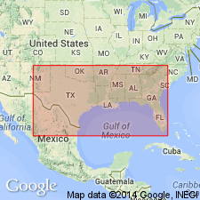
- Citronelle formation*
- Modifications:
-
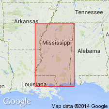
- Named
- Biostratigraphic dating
- Dominant lithology:
-
- Sand
- Clay
- Gravel
- AAPG geologic province:
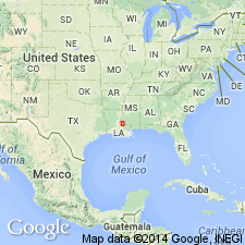
-
- Florida platform
- Mid-Gulf Coast basin
- Gulf Coast basin
Summary:
Named for town of Citronelle on Mobile and Ohio Railroad, northern Mobile Co., southwestern AL. Formerly classified as "Drift", "Orange sand", and "Lafayette" of other workers. Name is applied to chiefly nonmarine Pliocene sediments occurring near seaward margin of Gulf Coastal Plain between westernmost FL and eastern TX. Consists of yellow and red sands and clays, locally gray weathering, with much gravel near landward margin. Thickness ranges from 50 to 400 ft; thickest beds in LA and MS. Unconformably overlies Miocene Pascagoula clay; unconformably underlies Pleistocene St. Elmo terrace. Age is Pliocene based on stratigraphic position and flora, including TAXODIUM DISTICHUM, PINUS sp., YUCCA sp., HICORIA PRETEXANA, BETULA PRENIGRA, FAGUS LAMBERTENSIS, QUERCUS NIGRA, QUERCUS CATESBAEIFOLIA, QUERCUS PREVIRGINIANA, PLANERA AQUATICA, CAESALPININA CITRONELLENSIS, PRUNUS sp., VITIS sp., TRAPA ALABAMANENSIS, NYSSA AQUATICAFORMIS, BUMELIA PREANGUSTIFOLIA, and FRAXINUS sp. Best fossil locality is a few miles south of type locality, near Lamberts Station, where flora are sufficiently preserved to allow correlation of beds with later half of Pliocene.
Source: GNU records (USGS DDS-6; Reston GNULEX).
- Usage in publication:
-
- Citronelle Formation*
- Modifications:
-
- Age modified
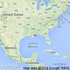
- AAPG geologic province:
-
- Mid-Gulf Coast basin
Summary:
Considered middle Pliocene to possible early Pleistocene age based on fossil leaves and Hemphillian (middle Pliocene) age based on vertebrate fauna in the Mid-Gulf Coast basin.
Source: GNU records (USGS DDS-6; Denver GNULEX).
- Usage in publication:
-
- Citronelle Formation
- Modifications:
-
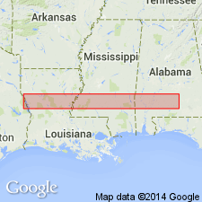
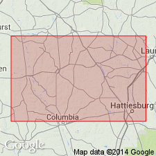
- Areal extent
- Overview
- AAPG geologic province:
-
- Mid-Gulf Coast basin
Summary:
Though deposits consisting of interbedded sands, gravels, and mottled lutites, especially those exhibiting red, hematite-coated weathering zones are described and mapped as the Citronelle, extension of the term into southern MS should be re-examined according to author. There are no precise boundaries with the underlying Miocene sediments. Some of the materials mapped as terraces in one area may be mapped as "Citronelle" in another.
Source: GNU records (USGS DDS-6; Reston GNULEX).
- Usage in publication:
-
- Citronelle Formation
- Modifications:
-
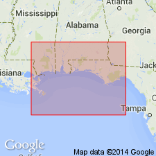
- Overview
- AAPG geologic province:
-
- South Georgia sedimentary province
Summary:
Age of Citronelle has been subject of debate for years. Originally assigned a late Pliocene age by Berry (1916) based on plant fossils in AL. Doering (1956) placed the unit in the early Pleistocene based on EQUUS teeth. String and LaMoreaux (1957) also found late Pliocene plant fossils similar to Berry's. Doering (1960) insisted on an early Pleistocene age based on Foraminifera. The Citronelle contains no index fossils and therefore, the age argument has not been completely resolved. The modern consensus is that the Citronelle is most likely late Pliocene and that age is adopted by this writer. In most wells in Gadsden Co., FL, it is the uppermost unit and generally varies from about 20 ft thick just east of Quincy to nearly 100 ft south of Chattahoochee.
Source: GNU records (USGS DDS-6; Reston GNULEX).
- Usage in publication:
-
- Citronelle Formation
- Modifications:
-
- Overview
- AAPG geologic province:
-
- Mid-Gulf Coast basin
Summary:
Regionally extensive Citronelle Formation typically consists of silty-sandy to gravelly-sandy fluvial upland deposits 10 to 25 m thick. (Some shoreface sediments have been reported from the FL panhandle.) In Liberty and Gadsden Cos., central panhandle FL, unit unconformably overlies the Jackson Bluff Formation and correlates with Miccosukee Formation to the east. Also interpreted as time equivalent of Cypresshead Formation of the East Coast. In western panhandle FL and southern AL, unconformably overlies Perdido Key Formation.
Source: GNU records (USGS DDS-6; Reston GNULEX).
- Usage in publication:
-
- Citronelle Formation
- Modifications:
-
- Overview
- AAPG geologic province:
-
- Mid-Gulf Coast basin
Summary:
The Citronelle is present in both Adams and Wilkinson Cos., MS, with the base of the formation near 300 ft. Lies unconformably on the Hattiesburg in the study area. Smectite is rare in the Citronelle, but abundant in the Hattiesburg. Table for field identification lists the following criteria: variable color, but usually orange-red, mostly coarse, with irregular beds of sands and gravels near base, lutite rip-up clasts common. Large scale cross-bedding present in places. Kaolinite is most abundant clay mineral. Contains manganese oxide-encrusted sand, gravel clasts. Age given as Pliocene and Pleistocene(?).
Source: GNU records (USGS DDS-6; Reston GNULEX).
- Usage in publication:
-
- Citronelle Formation
- Modifications:
-
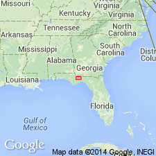
- Overview
- AAPG geologic province:
-
- Mid-Gulf Coast basin
Summary:
The Citronelle Formation is the most widely distributed unit in the study area, occurring in all 35 quads mapped in south-central MS, and occupying the highest elevations. It is composed of gravel and sandstone with a few thin layers of silt or clay. Has undergone considerable weathering. Contact with the underlying Hattiesburg Formation is an easily recognized regional unconformity, marked by a thin, dark-brown to black, iron-cemented sand. The lenses of clay consist dominantly of kaolinite and illite and tend to be laminated. Large-scale cross-bedding is evident. Underlies terrace deposits. Age is Pliocene and Pleistocene.
Source: GNU records (USGS DDS-6; Reston GNULEX).
- Usage in publication:
-
- Citronelle Formation
- Modifications:
-
- Overview
- AAPG geologic province:
-
- Mid-Gulf Coast basin
Summary:
In southern MS, the alluvial Pliocene Citronelle unconformably overlies the paralic-terrestrial deposits of the Graham Ferry Member of the newly revised Pensacola Formation. Muddy and gravelly coarse sandstones dominate in the Citronelle. Unit has been exposed to long and intense weathering, indicated by the hematite-gibbsite-kaolinite film that coats the sand grains. Weathering probably predates the early Pleistocene.
Source: GNU records (USGS DDS-6; Reston GNULEX).
- Usage in publication:
-
- Citronelle Formation*
- Modifications:
-
- Biostratigraphic dating
- AAPG geologic province:
-
- Mid-Gulf Coast basin
GNU Staff, 1995, Draft copy of Otvos, E.G., Mississippi Gulf Coast; geologic evolution, stratigraphy, coastal geomorphology, and Gulf-wide Pleistocene correlations, USGS Bull. XXXX (unpublished): U.S. Geological Survey Digital Data Series, DDS-6, 1 CD-ROM., release 3
Summary:
In the past, Citronelle Formation was dated as early Pleistocene (pre-glacial) based on pollen (Marsh, 1966), vertebrate (Isphording and Lamb, 1971), and mollusk (Marsh, 1966) data. This evidence is inconclusive. A Hemphillian (late Miocene to earliest Pliocene) vertebrate fauna was found in muddy pre-Citronelle upper Neogene sediments, but does not support Pleistocene age. A single Japanese umbrella pine pollen from a Citronelle peat lens suggested a Pliocene age because the species disappeared from North America after the Pliocene (D.A. Willard, written commun., 1994). Data from Citronelle in GA and FL by Huddlestun (1984, 1988) support Pliocene age. In eastern FL panhandle and adjacent GA, same interval is known as Miccosukee Formation. Correlative sediments in eastern GA are known as Cypresshead Formation, dated at 2.5 to 2.2 Ma (Huddlestun, 1988).
Source: GNU records (USGS DDS-6; Reston GNULEX).
For more information, please contact Nancy Stamm, Geologic Names Committee Secretary.
Asterisk (*) indicates published by U.S. Geological Survey authors.
"No current usage" (†) implies that a name has been abandoned or has fallen into disuse. Former usage and, if known, replacement name given in parentheses ( ).
Slash (/) indicates name conflicts with nomenclatural guidelines (CSN, 1933; ACSN, 1961, 1970; NACSN, 1983, 2005, 2021). May be explained within brackets ([ ]).