

- Usage in publication:
-
- Cieneguita beds
- Modifications:
-
- Original reference
- Dominant lithology:
-
- Shale
- AAPG geologic province:
-
- Permian basin
Summary:
Pg. 10-25. Cieneguita beds. Chiefly dark or almost black shales, but containing alterations of heavy lenticular masses of mortar rocks (indurated mixture of calcareous mud and siliceous fragments of variable sizes and wear), conglomerates, dark limestones, and mixtures of these materials. Thickness 1,000 feet. Fossiliferous. Basal formation of Chinati series. Underlies Alta beds and overlies granite. [Age is Permian.]
Named from Cienguita ranch, Shafter district, Presidio Co., southwestern TX.
Source: US geologic names lexicon (USGS Bull. 896, p. 444).
- Usage in publication:
-
- Cieneguita beds
- Modifications:
-
- Age modified
- AAPG geologic province:
-
- Permian basin
Summary:
Pg. 908. Cieneguita beds. Cieneguita and Alta beds, of Shafter region, formerly classed as Pennsylvanian, proved to be of Leonard (Permian) age. [See also C.L. Baker, 1929 (Univ. Texas Bull., no. 2901, p. 73+).]
Source: US geologic names lexicon (USGS Bull. 896, p. 444).
- Usage in publication:
-
- Cieneguita formation
- Modifications:
-
- Age modified
- Areal extent
- AAPG geologic province:
-
- Permian basin
Skinner, J.W., 1940, Upper Paleozoic section of Chinati Mountains, Presidio County, Texas: American Association of Petroleum Geologists Bulletin, v. 24, no. 1, p. 180-188.
Summary:
Pg. 182, 184 (fig. 2), 185. Cieneguita formation. Consists of approx. 1,000 feet of shale, sandstone, and limestone. Many sandstone and limestone beds are conglomeratic and contain small pebbles of clear quartz. Base of formation not exposed, its total thickness cannot be determined. To southeast underlies Alta formation with apparent conformity. Contact not sharp and arbitrarily placed at base of a heavy sandstone about 50 feet above highest limestone of the Cieneguita. Age is considered Pennsylvanian (Strawn and Canyon), based on fossils (FUSULINA, TRITICITES).
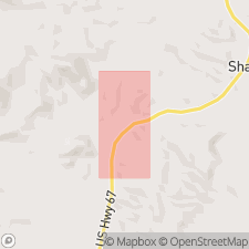
Typically exposed northwest of Sierra Alta [now Cerro Alto] along road leading from Shafter-Marfa highway to Cieneguita Ranch (= Udden's type locality).
Source: Publication.
- Usage in publication:
-
- Cieneguita formation
- Modifications:
-
- Age modified
- Mapped
- Dominant lithology:
-
- Conglomerate
- Sandstone
- Shale
- Limestone
- AAPG geologic province:
-
- Permian basin
Summary:
Fig. 3 (facing p. 24), p. 32 (table 1), 33-39, 164-166 (measured section 3), geol. map. Cieneguita formation. Alternating beds of quartz pebble conglomerate, ferruginous sand, sandy shale, and brecciated masses of reef limestone. Maximum thickness 2,083+/- feet. Notable exposures on east and southeast flanks of Ojo Bonito laccolith; base of formation truncated by the intrusion. Quaternary gravel and alluvium cover most of formation. Fossils [listed]. Age is Pennsylvanian (Strawn, Canyon, Cisco).
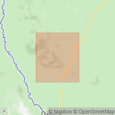
Type section [composite] stated: base of section exposed 1.75 mi N. 40 deg. E. of Cieneguita Ranch headquarters, 2.85 mi S. 42 deg. E. of Ojo triangulation station, [in vicinity of Lat. 29 deg. 57 min. 15 sec. N., Long. 104 deg. 20 min. 00 sec. W., Cieneguita 7.5-min quadrangle (1983 ed.), Presidio Co., southwestern TX]; top exposed about 200 yds due south of White's shipping pens on Cieneguita-Cibolo Ranch road, 2.8 mi west of junction with US Highway 67 [in vicinity of Lat. 29 deg. 55 min. 00 sec. N., Long. 104 deg. 18 min. 30 sec. W., Cieneguita 7.5-min quadrangle (1983 ed.), Presidio Co., southwestern TX].
[Additional locality information from USGS historical topographic map collection TopoView, accessed September 9, 2023.]
Source: Publication.
For more information, please contact Nancy Stamm, Geologic Names Committee Secretary.
Asterisk (*) indicates published by U.S. Geological Survey authors.
"No current usage" (†) implies that a name has been abandoned or has fallen into disuse. Former usage and, if known, replacement name given in parentheses ( ).
Slash (/) indicates name conflicts with nomenclatural guidelines (CSN, 1933; ACSN, 1961, 1970; NACSN, 1983, 2005, 2021). May be explained within brackets ([ ]).