

- Usage in publication:
-
- Cieneguilla limburgite
- Modifications:
-
- Original reference
- Dominant lithology:
-
- Basalt
- Conglomerate
- AAPG geologic province:
-
- Estancia basin
- San Juan basin
Summary:
Pg. 424 (fig. 3), 445-451. Cieneguilla limburgite. Proposed for series of flows and ejectamenta, with associated waterlaid beds, exposed in vicinity of La Cienega. Thickness at type locality 590 feet. At Cieneguilla, overlain with angular unconformity by Pleistocene alluvium of Santa Fe Plateau, Pleistocene basalt of the Mesa Negra, and by younger alluvium in Santa Fe Creek. Base of section not exposed; maximum stratigraphic interval during which a small body of augite quartz latite was intruded, solidified, and exposed by subsequent erosion. Appears to be Oligocene or earliest Miocene.
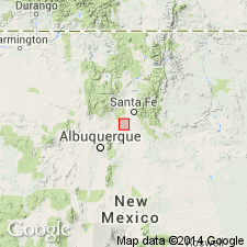
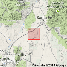
Type locality: Canyon of Santa Fe Creek between settlements of Canyon and Cieneguilla, Cerillos Hills, Galisteo-Tongue area. [Named from settlement of Cieneguilla, Santa Fe Co., NM.]
Source: US geologic names lexicon (USGS Bull. 1200, p. 801-802).
- Usage in publication:
-
- Cieneguilla iimburgite
- Modifications:
-
- Revised
- AAPG geologic province:
-
- Estancia basin
Summary:
Revised upper contact of Cieneguilla limburgite of Stearns (1953[a?]) in Santa Fe area, Santa Fe County, New Mexico, Estancia basin. Unconformably overlies Espinaso volcanics; conformably underlies Abiquiu(?) formation (revised), basal unit of Santa Fe group (revised). Age is Miocene(?) (from geologic map).
Source: Modified from GNU records (USGS DDS-6; Denver GNULEX).
For more information, please contact Nancy Stamm, Geologic Names Committee Secretary.
Asterisk (*) indicates published by U.S. Geological Survey authors.
"No current usage" (†) implies that a name has been abandoned or has fallen into disuse. Former usage and, if known, replacement name given in parentheses ( ).
Slash (/) indicates name conflicts with nomenclatural guidelines (CSN, 1933; ACSN, 1961, 1970; NACSN, 1983, 2005, 2021). May be explained within brackets ([ ]).