- Usage in publication:
-
- Cid Formation*
- Modifications:
-
- Named
- Dominant lithology:
-
- Mudstone
- Volcanics
- Tuff
- Basalt
- Breccia
- AAPG geologic province:
-
- Piedmont-Blue Ridge province
Summary:
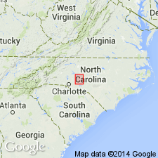
Named as a formation in Albemarle Group. Named for community of Cid in northwestern part of Denton quad, Davidson Co., central NC. No single, adequate exposure exists. Felsic flows may be seen in abandoned quarry at Bald Mountain, and at Crouse Mountain, Steep Rock, and the several peaks of Morrow State Park. Crystal lithic andesitic basalt tuff is exposed in railroad cut paralleling Yadkin River just north of Bald Mountain, and along east shore of Badin Lake. Agglomeratic andesitic basalt may be seen at Davidson Hill. Agglomeratic tuff may be seen 1 mi northwest of New Jerusalem Church. Good exposures of sedimentary rocks may be found along NC Hwys 8, 27, and 109. Includes a lower unnamed mudstone member that also contains some andesitic basalt and felsic volcanic rocks. Good exposures may be found along Cid Road from 1 mi west of Cid to 0.5 mi east of town of Jackson Creek. Also includes an upper Flat Swamp Member consisting of felsic volcanic rocks, andesitic basalt, and lentils of tuffaceous breccia. Best exposed on Flat Swamp and Wildcat Mountains and in roadcuts across these features. Gradationally overlies Tillery Formation; appears transitional with overlying Millingport Formation. Age is Ordovician(?) based on scattered fossils in Albemarle Group (J.M. Schopf, written commun.; Conley, 1960; St. Jean, 1965) and lead-alpha ages from zircons in Uwharrie Formation (underlies Albemarle Group) (White and others, 1963).
Source: GNU records (USGS DDS-6; Reston GNULEX).
For more information, please contact Nancy Stamm, Geologic Names Committee Secretary.
Asterisk (*) indicates published by U.S. Geological Survey authors.
"No current usage" (†) implies that a name has been abandoned or has fallen into disuse. Former usage and, if known, replacement name given in parentheses ( ).
Slash (/) indicates name conflicts with nomenclatural guidelines (CSN, 1933; ACSN, 1961, 1970; NACSN, 1983, 2005, 2021). May be explained within brackets ([ ]).

