The National Geologic Map Database is migrating to a new infrastructure. We apologize for any service disruptions during this process.
|
|---|


- Usage in publication:
-
- Cibao marl*
- Modifications:
-
- Revised
- AAPG geologic province:
-
- Caribbean region
Summary:
Sediments ranging from coarse bouldery gravel through sand, silt, clay, and marl to pure limestone, characterized by rapid lateral changes in lithology and intergrading both horizontally and vertically, are named the Rio Guatemala group. The San Sebastian formation represents the first interval of clastic deposition; the Lares limestone represents biohermal areas; and the Cibao marl (here redefined from limestone) with its Guajataca member (here named) represents the second interval of clastic deposition. Maximum thickness is 700 m. Unconformably overlies rocks of Late Cretaceous age; conformably underlies Aguada limestone. Age is Tertiary.
Source: GNU records (USGS DDS-6; Reston GNULEX).

- Usage in publication:
-
- Cibao formation*
- Modifications:
-
- Revised
- AAPG geologic province:
-
- Caribbean region
Summary:
The contact between the Lares limestone and the Cibao is revised as the continuous bed at the base of the Cibao and limestone above this bed is reassigned from the Lares to the Cibao, which is here renamed Cibao formation because of the varied character of its members. In Manati quadrangle it is divided into the Rio Indio limestone, Almirante Sur sand, Quebrada Arenas limestone, and Miranda sand members, interbedded or intertongued with tongues of typical chalk or marl of the Cibao. Age is Oligocene or Miocene.
Source: GNU records (USGS DDS-6; Reston GNULEX).
- Usage in publication:
-
- Cibao Formation*
- Modifications:
-
- Age modified
- AAPG geologic province:
-
- Caribbean region
Summary:
Age of Cibao Formation is late Oligocene and early Miocene.
Source: GNU records (USGS DDS-6; Reston GNULEX).
- Usage in publication:
-
- Cibao Formation*
- Modifications:
-
- Revised
- AAPG geologic province:
-
- Caribbean region
Summary:
In the Florida quad., the Cibao consists of the Montebello Limestone Member, here named, at the base, which rests sharply or disconformably on the Lares Limestone; calcareous clay or marl, the Quebrada Arenas Member, and calcareous clay and white to pink limestone of the upper member. Age is Oligocene and Miocene.
Source: GNU records (USGS DDS-6; Reston GNULEX).
- Usage in publication:
-
- Cibao Formation*
- Modifications:
-
- Revised
- AAPG geologic province:
-
- Caribbean region
Summary:
Mapping in 1966 and 1967 shows that contacts mapped in 1948 for the top and bottom of the Aguada become too low toward the west and are at a higher stratigraphic position. The type area near Aguada is entirely in the Cibao Formation that underlies the Aguada. As the name is firmly entrenched in the literature for the limestone beds between the Cibao and the Aymamon Limestone above, the name Aguada is retained and a special reference section is designated.
Source: GNU records (USGS DDS-6; Reston GNULEX).
- Usage in publication:
-
- Cibao Formation*
- Modifications:
-
- Revised
- AAPG geologic province:
-
- Caribbean region
Summary:
Almirante Sur Sand Member revised as Almirante Sur Sand Lentil of the Cibao Formation. Forms a lentil 30 to 40 m thick in the Rio Indio Limestone Member. Age is late Oligocene and (or) early Miocene.
Source: GNU records (USGS DDS-6; Reston GNULEX).

- Usage in publication:
-
- Cibao Formation*
- Modifications:
-
- Overview
- AAPG geologic province:
-
- Caribbean region
Summary:
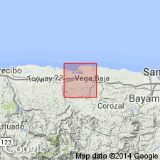
The Cibao Formation occurs on the north coast of Puerto Rico and consists of calcareous clay, marl, and chalky limestone. The unit is divided into the Miranda Sand Member, Quebrada Arenas Limestone Member, Almirante Sur Sand Lentil, Rio Indio Limestone Member, Montebello Limestone Member and the Guajataca Member. Thickness is 170 to 260 meters. The Cibao is of late Oligocene and early Miocene age.
Source: GNU records (USGS DDS-6; Reston GNULEX).
For more information, please contact Nancy Stamm, Geologic Names Committee Secretary.
Asterisk (*) indicates published by U.S. Geological Survey authors.
"No current usage" (†) implies that a name has been abandoned or has fallen into disuse. Former usage and, if known, replacement name given in parentheses ( ).
Slash (/) indicates name conflicts with nomenclatural guidelines (CSN, 1933; ACSN, 1961, 1970; NACSN, 1983, 2005, 2021). May be explained within brackets ([ ]).