The National Geologic Map Database is migrating to a new infrastructure. We apologize for any service disruptions during this process.
|
|---|


- Usage in publication:
-
- Chusa member
- Modifications:
-
- Original reference
- Dominant lithology:
-
- Clay
- Bentonite
- AAPG geologic province:
-
- Gulf Coast basin
Summary:
Pg. 65, 89-105, 178-179. Chusa member of Gueydan formation. Primarily friable tuffaceous clays and impure bentonites which have evidently been formed by action of streams on underlying Soledad and Fant members of Gueydan formation. Thickness 160+ feet. Is top member of Gueydan formation. Grades into underlying Soledad member of Gueydan formation and is unconformably or disconformably overlain by Oakville formation. Traced to northwest it overlies, apparently conformably, typical Catahoula sandstone of Gonzales and Lavaca Counties, southwestern Texas, and occupies stratigraphic position of Floeming clay. It is therefore quite possible it is of early Miocene age.
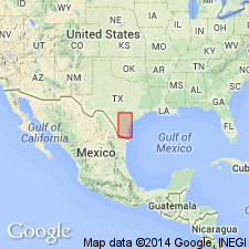
Named from exposures on slopes of La Chusa Mesa, in southeastern McMullen Co., southwestern TX coastal plain.
Source: US geologic names lexicon (USGS Bull. 896, p. 443).

- Usage in publication:
-
- Chusa tuff member*
- Modifications:
-
- Overview
- AAPG geologic province:
-
- Gulf Coast basin
Summary:
Chusa tuff member of Catahoula tuff. The Gueydan formation is now [ca. 1936] considered same as Catahoula tuff, and "Gueydan" has been abandoned by both Texas Geol. Survey and the USGS. The Chusa is therefore now treated as a member of Catahoula tuff. Age is Tertiary (early Miocene or Oligocene). Recognized in southwestern Texas Coastal Plain.
Source: US geologic names lexicon (USGS Bull. 896, p. 443).

- Usage in publication:
-
- Chusa Tuff Member*
- Modifications:
-
- Mapped 1:250k
- Dominant lithology:
-
- Mudstone
- Clay
- AAPG geologic province:
-
- Gulf Coast basin
Summary:
Chusa Tuff Member of Catahoula Formation. Mudstone and clay, tuffaceous, light-gray to pink, massive to irregularly bedded. Thickness about 180 feet. Is uppermost member of Catahoula Formation. Lies above Soledad Volcanic Conglomerate Member of Catahoula and below Oakville Sandstone. Age is Miocene.
[Mapped in northwestern Duval Co., southern TX.]
Source: Publication.
For more information, please contact Nancy Stamm, Geologic Names Committee Secretary.
Asterisk (*) indicates published by U.S. Geological Survey authors.
"No current usage" (†) implies that a name has been abandoned or has fallen into disuse. Former usage and, if known, replacement name given in parentheses ( ).
Slash (/) indicates name conflicts with nomenclatural guidelines (CSN, 1933; ACSN, 1961, 1970; NACSN, 1983, 2005, 2021). May be explained within brackets ([ ]).