The National Geologic Map Database is migrating to a new infrastructure. We apologize for any service disruptions during this process.
|
|---|


- Usage in publication:
-
- Churn Creek member
- Modifications:
-
- Original reference
- Dominant lithology:
-
- Shale
- Sandstone
- AAPG geologic province:
-
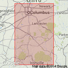
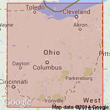
- Appalachian basin
- Cincinnati arch
Summary:
Pg. 656, 657, 763. Churn Creek member of Cuyahoga formation. Argillaceous shale with an occasional thin sandstone passing gradually into underlying Vanceburg sandstone member. Thickness 50 to 100 or more feet. Present only in southwestern part of Scioto and eastern Adams Counties, southern Ohio, and only in vicinity of Buena Vista is Logan formation found overlying it. Is top member of Cuyahoga formation in southwestern Scioto County. [Cuyahoga as used above includes lower part of Black Hand formation, to which these beds belong. Age is Mississippian.]
Named from Churn Creek, southeastern part of Adams Co., southern OH.
Source: US geologic names lexicon (USGS Bull. 896, p. 443).
- Usage in publication:
-
- Churn Creek shale member
- Modifications:
-
- Revised
- Areal extent
- AAPG geologic province:
-
- Appalachian basin
- Cincinnati arch
Summary:
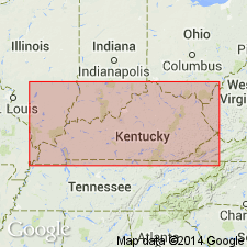
Pg. 77, 134, pl. 6. Churn Creek shale member of New Providence formation. In upper part of New Providence column in Lewis County, Kentucky, siltstone beds become fewer as well as thinner, with argillaceous to silty shale becoming prevalent; no sharp break occurs between these two divisions. This upper zone, 75 to 100 feet thick, is interpreted as the "Churn Creek" of Hyde (1915) and termed Churn Creek shale member. Occurs above Vanceburg siltstone member in Vanceburg facies of formation. Age is considered Early Mississippian.
Source: US geologic names lexicon (USGS Bull. 1200, p. 798-799).

- Usage in publication:
-
- Churn Creek siltstone and shale member
- Modifications:
-
- Revised
- AAPG geologic province:
-
- Cincinnati arch
Summary:
Pg. 173; Jour. Geol., v. 50, no. 1, p. 41 (table 2), 63-64. Churn Creek siltstone and shale member included in Vanceburg facies of Logan formation in Ohio. Underlies Vinton sandstone member; overlies Vanceburg siltstone member, but no dependable horizon separates the two, distinction being made on the basis of larger sandstone content of Vanceburg. [Age is Early Mississippian.]
Source: US geologic names lexicon (USGS Bull. 1200, p. 798-799).
- Usage in publication:
-
- Churn Creek member
- Modifications:
-
- Revised
- AAPG geologic province:
-
- Cincinnati arch
Summary:
Pg. 3 (table 1), 25. Churn Creek member of Cuyahoga formation. Here considered member of Cuyahoga formation in Vanceburg facies. [Age is Early Mississippian.]
Editor's note states Hyde (1921, Ohio Geol. Survey Bull., no. 23) correlated Buena Vista sandstone with Berne and lower portion of Byer in discussing geology of Camp Sherman quadrangle; such a correlation would necessitate placing Rarden, Vanceburg, Churn Creek, and most of Portsmouth shale in Logan formation.
Source: US geologic names lexicon (USGS Bull. 1200, p. 798-799).
- Usage in publication:
-
- Churn Creek member
- Modifications:
-
- Biostratigraphic dating
- AAPG geologic province:
-
- Appalachian basin
Summary:
Pg. 145, 147, 219 (Chart 19), 226, 229, 283. Churn Creek member of New Providence formation. Age is considered Early Mississippian (Osagean) based on forams REOPHAX MCDONALDI n. sp. and HYPERAMMINA sp. fragments. R. MCDONALDI occurs only in Churn Creek member in Kentucky and in Black Hand sandstone member of Cuyahoga formation of Ohio.
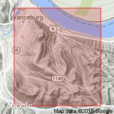
R. MCDONALDI type specimen collected from roadcut along Vanceburg-Tannery Road, beginning 1.25 mi south of Chesapeake and Ohio RR station at Vanceburg, Lat. 38 deg. 35 min. 05 sec. N., Long. 83 deg. 19 min. W., Vanceburg quadrangle, Lewis County, Kentucky (measured section of Stockdale, 1939, p. 98, 99).
Source: Publication.
- Usage in publication:
-
- Churn Creek Member
- Modifications:
-
- Areal extent
- AAPG geologic province:
-
- Cincinnati arch
Summary:
Churn Creek Member of Cuyahoga Formation was deposited in a prodelta environment. Overlies Vanceburg Member of Cuyahoga and underlies Logan Formation. Age is Mississippian.
Source: GNU records (USGS DDS-6; Reston GNULEX).
For more information, please contact Nancy Stamm, Geologic Names Committee Secretary.
Asterisk (*) indicates published by U.S. Geological Survey authors.
"No current usage" (†) implies that a name has been abandoned or has fallen into disuse. Former usage and, if known, replacement name given in parentheses ( ).
Slash (/) indicates name conflicts with nomenclatural guidelines (CSN, 1933; ACSN, 1961, 1970; NACSN, 1983, 2005, 2021). May be explained within brackets ([ ]).