- Usage in publication:
-
- Church Member
- Modifications:
-
- Named
- Dominant lithology:
-
- Fanglomerate
- Sand
- Silt
- AAPG geologic province:
-
- Basin-and-Range province
Summary:
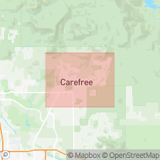
Named as member of Carefree Formation (new). Named for Good Shepherd of the Hills Episcopal Church. Type section is excavation cut found behind church in town of Cave Creek, Cave Creek quad, northern Maricopa Co., central AZ. Also exposed at northern base of western half of Black Mountain at T6N, R4E, secs. 27 and 28. Consists of dark-gray, moderately consolidated, moderately to poorly sorted, generally horizontally bedded fanglomerate characterized by high percentage of clasts (96% meta-argillite, 3% basalt, 1% granite); those larger than 0.4 in. in diameter, appear angular, elongate, tabular, and enclosed within gray, brown to dark-brown sandy-silt matrix. Basalt clasts distinguished as brown to gray, vesicular, and moderately to severely weathered. From exposures near type locality, maximum thickness measures at least 80 feet. Wells 122, 139, and 140 have penetrated fanglomerate 30, 300, and 400 feet, respectively. Conformably overlies Miocene tuff and basalt and, where volcanic rocks absent, lies unconformably on Middle Proterozoic (1400 Ma) Camelback Granite (new) and Precambrian meta-argillite--phyllite complex. Lateral contacts are buried, but probably grade laterally into late Miocene and early Pliocene Galloway Member to northwest and into Grapevine Member to east (both new). Age is late Miocene and early Pliocene based on constraining minimum radiometric date of <13.4 Ma of White Eagle Mine Formation (new). Report includes geologic map and cross section, and stratigraphic nomenclature table.
Source: GNU records (USGS DDS-6; Denver GNULEX).
For more information, please contact Nancy Stamm, Geologic Names Committee Secretary.
Asterisk (*) indicates published by U.S. Geological Survey authors.
"No current usage" (†) implies that a name has been abandoned or has fallen into disuse. Former usage and, if known, replacement name given in parentheses ( ).
Slash (/) indicates name conflicts with nomenclatural guidelines (CSN, 1933; ACSN, 1961, 1970; NACSN, 1983, 2005, 2021). May be explained within brackets ([ ]).

