- Usage in publication:
-
- Christensen Ranch Metasedimentary Suite*
- Modifications:
-
- Named
- Dominant lithology:
-
- Quartzite
- Iron-formation
- Marble
- Schist
- Gneiss
- AAPG geologic province:
-
- Northern Rocky Mountain region
Summary:
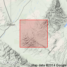
Type area: northwest-facing slope, Ruby Range, Ts7 and 8S, R7W, Madison and Beaverhead Cos, MT in Northern Rocky Mountain region. Geologic maps. Some of the mappable units are traced for miles. Original stratigraphic order destroyed by displacements on bedding plane faults and by nappe development. Thickness estimate 6,400 ft. Dolomite marble the oldest? unit is in contact with Middle or Late Archean quartzofeldspathic gneiss. Marble is: white, gray or buff; massive to well bedded; fine to medium grained; in steeply dipping belts, some several thousand ft in outcrop width; occurs in other three units. Quartzite is: white to brown; sugary to vitreous; 90 percent quartz; occurs throughout range in layers less than 1 inch to 100 ft thick; squeezed into thick lenses and boudins by tectonic deformation. Iron-formation is: a minor but distinctive component; in beds less than 1 ft to 100 ft thick; in quartz-rich discontinuous layers with layers of magnetite; fine to medium grained granular. Metasedimentary rocks are 1) quartz mica schist and quartzose gneiss, 2) calc-silicate gneiss and schist, 3) anthophyllite schist that forms interbeds in other units. Detailed lithologic descriptions. Correlation with Cherry Creek Group of Gravelly Range uncertain. Intruded by Middle or Late Archean ultramafic rocks, and Late Archean (2,750 m.y.) granite. Lower age limit unknown. Shallow marine unit of Middle or Late Archean age.
Source: GNU records (USGS DDS-6; Denver GNULEX).
For more information, please contact Nancy Stamm, Geologic Names Committee Secretary.
Asterisk (*) indicates published by U.S. Geological Survey authors.
"No current usage" (†) implies that a name has been abandoned or has fallen into disuse. Former usage and, if known, replacement name given in parentheses ( ).
Slash (/) indicates name conflicts with nomenclatural guidelines (CSN, 1933; ACSN, 1961, 1970; NACSN, 1983, 2005, 2021). May be explained within brackets ([ ]).

