- Usage in publication:
-
- Chopawamsic Formation*
- Modifications:
-
- Named
- Dominant lithology:
-
- Volcanics
- Phyllite
- Metagraywacke
- AAPG geologic province:
-
- Piedmont-Blue Ridge province
Summary:
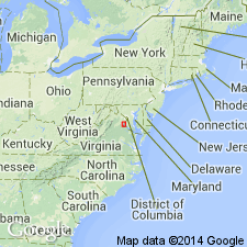
Named for Chopawamsic Creek, Quantico Marine Base, Joplin 7.5-min quad, northeastern VA. Occurs on northwestern limb of Quantico syncline in Occoquan, Quantico, Joplin, and Stafford 7.5-min quads, Prince William and Stafford Cos., VA. Type section is along Chopawamsic Creek, southwest to southeast of Joplin, VA. Reference sections are located along Quantico Creek in Prince William Park and along north shore of new reservoir on Aquia Creek and along the creek. Consists of three principal lithological units: 1) metamorphosed medium- to thick-bedded mafic to intermediate volcanic rocks derived from andesitic to basaltic flows, coarse breccias, and finer tuffaceous rocks; 2) metamorphosed medium- to thick-bedded felsic volcanic rocks derived from flows and associated volcaniclastic accumulations; and 3) metamorphosed thin- to medium-bedded volcaniclastic rocks of felsic to mafic composition, locally containing beds of nonvolcanic quartzose metagraywacke, green to gray phyllite, and felsic to mafic flows. Thickness estimated at 10,000 ft. Grades into overlying Quantico Formation; lower contact with Wissahickon is abrupt and exhibits mineralogical change. Age is Cambrian or Ordovician based on stratigraphic position between Late Ordovician Quantico Formation and late Precambrian(?) Wissahickon Formation.
Source: GNU records (USGS DDS-6; Reston GNULEX).
- Usage in publication:
-
- Chopawamsic Formation
- Modifications:
-
- Age modified
- Geochronologic dating
- AAPG geologic province:
-
- Piedmont-Blue Ridge province
GNU Staff, 1992, GNU staff remark by E.D. Koozmin. Chopawamsic Formation.: U.S. Geological Survey Digital Data Series, DDS-6, 1 CD-ROM., release 3
Summary:
Discussion with Louis Pavlides in July, 1992, regarding current thought on age of Chopawamsic indicates that age in southern Virginia is Early Cambrian, based on 550 Ma isotope date; however, A.K. Sinha obtained 530 Ma date for other parts of Chopawamsic. Pavlides feels that overall age of Chopawamsic is Cambrian, but in southeastern Virginia, age should be specifically Early Cambrian. He refers reader to table 6 in Pavlides (1989) which shows Chopawamsic spanning the Cambrian, based on isotopic dates in Pavlides (1981). Pavlides (1981) in turn states that 550 Ma age is from Tilton and others (1970) and Higgins and others (1971). Tilton and others (1970) do not use the name Chopawamsic, as it was not yet named, but zircon data for James Run Gneiss yielded date of 550 Ma. Higgins and others (1971) state that recently named Chopawamsic Formation correlates with James Run Formation, which they feel is in part Cambrian based on Pb-Pb and Pb-U dating on zircons.
BIBLIOGRAPHY
1. Higgins, M.W., Sinha, A.K., Tilton, G.R., and Kirk, W.S., 1971, Correlation of metavolcanic rocks in the Maryland, Delaware, and Virginia Piedmont [abs.]: Geological Society of America, Abstracts with Programs, v. 3, no. 5, p. 320.
2. Pavlides, Louis, 1981, The central Virginia volcanic-plutonic belt--An island arc of Cambrian(?) age: U.S. Geological Survey Professional Paper 1231-A, 34 p.
3. Pavlides, Louis, 1989, Early Paleozoic composite melange terrane, central Appalachian Piedmont, Virginia and Maryland; its origin and tectonic history, IN Melanges and olistostromes of the U.S. Appalachians: Geological Society of America Special Paper 228, p. 135-193).
4. Tilton, G.R., Doe, B.R., and Hopson, C.A., 1970, Zircon age measurements in the Maryland Piedmont, with special reference to Baltimore Gneiss problems, chapter 29 IN Fisher and others, eds., Studies of Appalachian geology--central and southern: New York, Interscience Publishers, p. 429-434.
Source: GNU records (USGS DDS-6; Reston GNULEX).

- Usage in publication:
-
- Chopawamsic Formation
- Modifications:
-
- Overview
- AAPG geologic province:
-
- Piedmont-Blue Ridge province
Summary:
Chopawamsic Formation on the VA State map is divided into three map units. Glenarm Group not used. Chopawamsic (undivided) includes laterally discontinuous lenses and tongues of metamorphosed felsic, intermediate, and mafic volcanic flows and volcaniclastic rocks with interlayered quartzite, quartzose graywacke, schist, and phyllite. It is unconformably overlain by the Late Ordovician Arvonia and Quantico Formations. Second map unit is light-gray to white, medium-grained, foliated felsite ranging in composition from rhyolite to dacite. Third map unit is dark greenish-gray, fine- to medium-grained, foliated, lineated, amphibole-bearing gneiss and schist and includes tuffaceous volcaniclastic rocks. Age is Cambrian.
Source: GNU records (USGS DDS-6; Reston GNULEX).

- Usage in publication:
-
- Chopawamsic Formation*
- Modifications:
-
- Overview
Summary:
Chopawamsic Formation and its probable correlative to the northeast in MD, James Run Gneiss, are of Cambrian, possibly Early Cambrian, age based on discordant zircon data.
Source: GNU records (USGS DDS-6; Reston GNULEX).
For more information, please contact Nancy Stamm, Geologic Names Committee Secretary.
Asterisk (*) indicates published by U.S. Geological Survey authors.
"No current usage" (†) implies that a name has been abandoned or has fallen into disuse. Former usage and, if known, replacement name given in parentheses ( ).
Slash (/) indicates name conflicts with nomenclatural guidelines (CSN, 1933; ACSN, 1961, 1970; NACSN, 1983, 2005, 2021). May be explained within brackets ([ ]).

