

- Usage in publication:
-
- Chokecherry dolomite*
- Modifications:
-
- Original reference
- Dominant lithology:
-
- Dolomite
- AAPG geologic province:
-
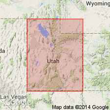
- Great Basin province
Summary:
Pg. 421-432. Chokecherry dolomite. Characterized by considerable silica, which occurs both as nodules and bands of chert, usually of dark gray to black color, and as sandy laminae between thin beds of dolomite. Lower beds as a rule are rather massively bedded chert-bearing dark-mottled dolomite, locally oolitic and cross-bedded and containing thin lenses of dolomitic conglomerate. These beds are supplanted higher in formation by thinner bedded dolomite with sandy laminae or, locally, by bands of chert. Lower Ordovician fossils near top. Thickness 850 to l,060+ feet. Absent in northern part of area, so that there must be pronounced unconformity above the formation. Lies unconformably on Hicks formation and is overlain by Fish Haven dolomite. Age is considered Lower Ordovician.
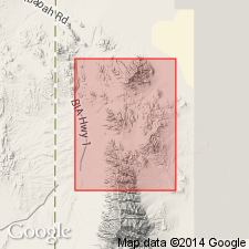
Named from exposures in Chokecherry Canyon, just south of Gold Hill quadrangle, [in secs. 2 and 3, T. 10 S., R. 18 W., Goshute Canyon 7.5-min quadrangle], Gold Hill district, Tooele Co., western UT.
[See also Nolan's USGS Prof. Paper 177, 1935.]
Source: US geologic names lexicon (USGS Bull. 896, p. 438).
- Usage in publication:
-
- Chokecherry dolomite*
- Modifications:
-
- Age modified
- AAPG geologic province:
-
- Great Basin province
Summary:
Age changed from Early Ordovician to Late Cambrian and Ordovician?. See fig. 6. [No explanation included in report.] Area of Chokecherry use attributed to Nolan (1930) which is in the Gold Hill quad, Tooele Co, UT in the Great Basin province. Correlation chart.
Source: GNU records (USGS DDS-6; Denver GNULEX).
For more information, please contact Nancy Stamm, Geologic Names Committee Secretary.
Asterisk (*) indicates published by U.S. Geological Survey authors.
"No current usage" (†) implies that a name has been abandoned or has fallen into disuse. Former usage and, if known, replacement name given in parentheses ( ).
Slash (/) indicates name conflicts with nomenclatural guidelines (CSN, 1933; ACSN, 1961, 1970; NACSN, 1983, 2005, 2021). May be explained within brackets ([ ]).