

- Usage in publication:
-
- Chloropagus formation
- Modifications:
-
- Original reference
- AAPG geologic province:
-
- Great Basin province
Summary:
Pg. 95-97, 138-139, fig. 5, 6, 8. Chloropagus formation. Section exposed in Green Hill area is (ascending) basalt more than 500 feet; breccia and agglomerate, 500 feet; basalt, 200 feet; tuff and breccia grading to siliceous shale, 50 feet; basalt, 450 feet; siliceous shale, 5 feet ; tuffaceous sandstone and shale, 15 feet; basalt, 200 feet. Aggregate thickness over 1,920 feet. Base not exposed in Hot Springs Range but supposedly rests on basement rock. Conformably underlies Desert Peak formation (new). Southwest of Fallon, conformably overlies Old Gregory formation (new). Rocks show several important facies changes as they are traced away from Chloropagus. Age is Miocene and Pliocene (early Clarendonian) [current age (ca. 1992) is late Miocene].
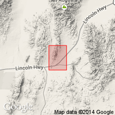
Type area: in middle foothills of Hot Springs (Kawsoh) Mountains 1 to 2 mi north of Desert Peak, in vicinity of Green Hill (Chloropagus), Desert Peak 7.5-min quadrangle, [Churchill Co.], western NV. Identified over wide area in western Trinity Range to north, and also crops out 30 mi north of Desert Peak, and adjacent hills to northeast and southwest.
Source: US geologic names lexicon (USGS Bull. 1200, p. 786-787); supplemental information from GNU records (USGS DDS-6; Menlo GNULEX).
- Usage in publication:
-
- Chloropagus Formation
- Modifications:
-
- Biostratigraphic dating
- AAPG geologic province:
-
- Great Basin province
Summary:
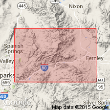
Pg. 3 (fig. 2), 4-7. Chloropagus Formation. Chiefly andesite and basalt lava flows, with local breccias and occassional interbeds of rhyolitic tuffs. Associated sediments, sandwiched between the lavas, are for most part represented by thin (1 to 2 m) lake beds composed of varicolored fissile shale, carrying the Purple Mountain flora (67 species; 9 florules). Thickness about 760 m. Well exposed in vicinity of Truckee River Canyon where the florules occur. Underlies Kate Peak Andesite (13 Ma); overlies Old Gregory Tuff (15 Ma), Alta Andesite (22 Ma), or Hartford Hill Rhyolite (23 Ma). Age is considered middle Miocene. Is contemporaneous with late Barstovian NALMA and with transitional marine Luisian-Relizian foraminferal stages in California as charted by Turner (1970).
Source: Publication.
For more information, please contact Nancy Stamm, Geologic Names Committee Secretary.
Asterisk (*) indicates published by U.S. Geological Survey authors.
"No current usage" (†) implies that a name has been abandoned or has fallen into disuse. Former usage and, if known, replacement name given in parentheses ( ).
Slash (/) indicates name conflicts with nomenclatural guidelines (CSN, 1933; ACSN, 1961, 1970; NACSN, 1983, 2005, 2021). May be explained within brackets ([ ]).