

- Usage in publication:
-
- Chiquito Peak Tuff*
- Modifications:
-
- Named
- Dominant lithology:
-
- Tuff
- Dacite
- AAPG geologic province:
-
- San Luis basin
Summary:
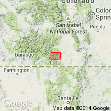
Named as uppermost formation within Treasure Mountain Group (rank raised). Type locality designated as palisade exposures on southwest flank of Chiquito Peak, for which unit is named, in north-central Conejos Co, CO (San Luis basin). These rocks, previously assigned to Masonic Park Tuff (revised) (and, at Cornwall Mountain, to La Jara Canyon Tuff (rank raised) of Treasure Mountain), are now recognized as major ash-flow sheet that erupted from Platoro volcanic complex. Unit extends from north of Del Norte south to CO-NM border (fig. 2). Unit is petrologically uniform crystal-rich dacite, characterized by phenocrysts of plagioclase, biotite, augite, and sparse sanidine. Outflow tuff sheet is typically only partly welded and vapor-phase crystallized; contains ubiquitous 1-2 cm lithic fragments of mainly brownish andesite; color is commonly light tan to gray-tan. Intracaldera tuff is densely welded, dark gray, and intensely propylitically and hydrothermally altered. At type overlies South Fork Tuff (new), Ra Jadero Tuff (rank raised), and older tuff sheets all of Treasure Mountain; overlain by distal Fish Canyon Tuff and volcanics of Green Ridge of Dungan and others (1989, New Mexico Bur. Mines and Min. Res. Mem. 46). At type thickness is about 100 m; at Cornwall Mountain, intracaldera tuff is greater than 800 m. Total volume is estimated at 1000 cu km (table 1). Ar-Ar age is 28.4 Ma (Oligocene).
Source: GNU records (USGS DDS-6; Denver GNULEX).
For more information, please contact Nancy Stamm, Geologic Names Committee Secretary.
Asterisk (*) indicates published by U.S. Geological Survey authors.
"No current usage" (†) implies that a name has been abandoned or has fallen into disuse. Former usage and, if known, replacement name given in parentheses ( ).
Slash (/) indicates name conflicts with nomenclatural guidelines (CSN, 1933; ACSN, 1961, 1970; NACSN, 1983, 2005, 2021). May be explained within brackets ([ ]).