- Usage in publication:
-
- Chiputneticook Quartz Monzonite*
- Modifications:
-
- Named
- Dominant lithology:
-
- Quartz monzonite
- Granite
- AAPG geologic province:
-
- New England province
Summary:
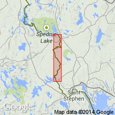
Named for Chiputneticook Lakes, International Boundary, Maine and New Brunswick. Outcrops most common in Danforth, Forest and Vanceboro quads. Consists of light-gray to gray, coarse-grained, biotitic, porphyritic quartz monzonite to granite; average grain size exceeds 0.25 in.; where porphyritic, euhedral potassic feldspar phenocrysts 0.25 in. by 1 in. to 0.5 by 2 in. in places show rapakivi texture. Porphyritic texture commonly extends to within a few feet of border of pluton. Is stratigraphic equivalent of granite and quartz monzonite in Danforth quad. Age determined by K-Ar as 400 m.y. in Danforth quad (Faul and others, 1963) and 380 m.y. in Fosterville, N.B., area (Tupper and Hart, 1961). Intrudes rocks of Silurian age. Age is Devonian.
Source: GNU records (USGS DDS-6; Reston GNULEX).
For more information, please contact Nancy Stamm, Geologic Names Committee Secretary.
Asterisk (*) indicates published by U.S. Geological Survey authors.
"No current usage" (†) implies that a name has been abandoned or has fallen into disuse. Former usage and, if known, replacement name given in parentheses ( ).
Slash (/) indicates name conflicts with nomenclatural guidelines (CSN, 1933; ACSN, 1961, 1970; NACSN, 1983, 2005, 2021). May be explained within brackets ([ ]).

