

- Usage in publication:
-
- Chipola formation*
- Modifications:
-
- Named
- Dominant lithology:
-
- Clay
- Marl
- Sand
- AAPG geologic province:
-
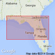
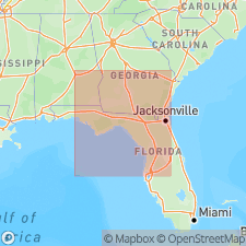
- Florida platform
- Mid-Gulf Coast basin
Summary:
Named as basal formation of Alum Bluff group. Named for exposures on Chipola River, Jackson Co., northwestern FL (panhandle). Includes sediments previously called Chipola marl member by other workers as well as overlying sands and clays up to horizon of Oak Grove sand. Consists of clays, marls, and sands. Characterized by distinctive fauna. Overlies Chattahoochee formation; is stratigraphically lower than Oak Grove sand. Age is Miocene [early].
Source: GNU records (USGS DDS-6; Reston GNULEX).
- Usage in publication:
-
- Chipola
- Modifications:
-
- Not used
- AAPG geologic province:
-
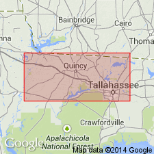
- Mid-Gulf Coast basin
Summary:
Alum Bluff Group referred to as undifferentiated in this report. Because formations assigned by previous workers were differentiated on the basis of micro- and macrofossil faunas and implied age, not lithology, and do not satisfy the requirements of the Code, they are not used by this author. Alum Bluff is described in several outcrops and includes sediments differentiated as Chipola, Shoal River, Oak Grove, Whites Creek, Choctawhatchee, Red Bay, and Yellow River by others. Lower 6 ft of Outcrop 15 at Ten Mile Creek in Calhoun Co. previously mapped as Chipola by Cooke and Mossom (1929) because of the age of the mollusks contained within it, but here referred to Alum Bluff undifferentiated.
Source: GNU records (USGS DDS-6; Reston GNULEX).
- Usage in publication:
-
- "Chipola-like" sediments
- Modifications:
-
- Overview
- Areal extent
- AAPG geologic province:
-
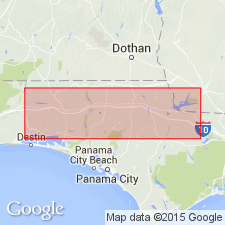
- South Georgia sedimentary province
Summary:
Chipola Formation is restricted in occurrence to the east central panhandle area including Bay, Calhoun, Liberty, and possibly Gulf Cos. Beds with a lithology similar to the type Chipola have been traced in cores into Gulf Co. by Schmidt (1984). These beds however are significantly different in age from the type Chipola. Near the type area the Chipola has been dated by microfossils as late early Miocene to early middle Miocene. In Gulf Co., the "Chipola-like" beds have not been directly dated, but overlie the middle Miocene to late Pliocene Intracoastal Formation and therefore have been placed in the late Pliocene. Thickness of this unit in Gulf Co. ranges from 0 to 50 ft.
Source: GNU records (USGS DDS-6; Reston GNULEX).
- Usage in publication:
-
- Chipola Formation
- Modifications:
-
- Age modified
- AAPG geologic province:
-
- Florida platform
Summary:
Chipola and Torreya Formations interfinger in the subsurface at Alum Bluff. The Chipola, however, is largely older than the Torreya. New 87Sr/86Sr age estimates for the Chipola from four mollusk samples collected near the top of the unit yield ages between 18.3 and 18.9 (+/-1.0) Ma, considerably older than previous interpretations. Occurrence of a small vertebrate fauna of late Hemingfordian or early Barstovian age in the "Fort Preston sand," which overlies the Chipola, supports the new age estimate.
Source: GNU records (USGS DDS-6; Reston GNULEX).
- Usage in publication:
-
- Chipola Formation
- Modifications:
-
- Geochronologic dating
- AAPG geologic province:
-
- Florida platform
Summary:
Authors use 87Sr/86Sr isotopic analyses in an attempt to resolve age relations of fossiliferous marine units that contain the remains of terrestrial vertebrates. Two specimens from the Chipla Formation exposed along Tenmile Creek, yielded a mean age of 18.7 Ma. This age is in agreement with that ascertained by Bryant and others (1992). Data presented here supports the conclusion that there is considerable chronologic overlap between the lower Torreya Formation and the upper Chipola.
Source: GNU records (USGS DDS-6; Reston GNULEX).
For more information, please contact Nancy Stamm, Geologic Names Committee Secretary.
Asterisk (*) indicates published by U.S. Geological Survey authors.
"No current usage" (†) implies that a name has been abandoned or has fallen into disuse. Former usage and, if known, replacement name given in parentheses ( ).
Slash (/) indicates name conflicts with nomenclatural guidelines (CSN, 1933; ACSN, 1961, 1970; NACSN, 1983, 2005, 2021). May be explained within brackets ([ ]).