

- Usage in publication:
-
- China Hat pediment and gravels
- Modifications:
-
- Named
- Dominant lithology:
-
- Gravel
- AAPG geologic province:
-
- San Joaquin basin
Summary:
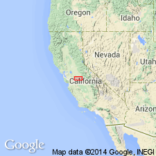
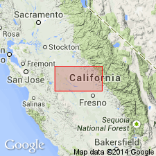
Name China Hat pediment credited to Hudson (1960). Gravel mantles China Hat pediment, an old erosion surface truncating Mehrten formation in San Joaquin Valley in vicinity of Merced River, Merced Co, CA. Is a 20- to 40-ft layer of gravel, consisting largely of 2- to 6-inch pebbles and cobbles of vein quartz, quartzite, and other hard metamorphic rocks. Shown on sketch map of San Joaquin Valley in vicinity of Merced River. Age given as late Pliocene based on stratigraphic relations.
Source: GNU records (USGS DDS-6; Menlo GNULEX).
- Usage in publication:
-
- China Hat Gravel Member*
- Modifications:
-
- Adopted
- Revised
- AAPG geologic province:
-
- San Joaquin basin
Summary:
Term "China Hat pediment" credited to Hudson (1960). Type section designated as China Hat, conical hill, sec. 32, T5S R15E, Haystack 7.5' quad, Merced Co., CA. Adopted as local uppermost member of upper unit of Laguna Formation. China Hat Gravel member is not a pediment but rather remnant of late Laguna gravelly fan deposit near its apex, now prominently exposed through topographic inversion. Well exposed in Main Canal cut where consists of 18.2 m of interstratified arkosic silt, sand, and gravel. Conformably overlies arkosic sedimentary rocks of Laguna Formation. Shown on geologic map of Merced-Madera area, San Joaquin Valley as Pliocene age.
Source: GNU records (USGS DDS-6; Menlo GNULEX).
For more information, please contact Nancy Stamm, Geologic Names Committee Secretary.
Asterisk (*) indicates published by U.S. Geological Survey authors.
"No current usage" (†) implies that a name has been abandoned or has fallen into disuse. Former usage and, if known, replacement name given in parentheses ( ).
Slash (/) indicates name conflicts with nomenclatural guidelines (CSN, 1933; ACSN, 1961, 1970; NACSN, 1983, 2005, 2021). May be explained within brackets ([ ]).