The National Geologic Map Database is migrating to a new infrastructure. We apologize for any service disruptions during this process.
|
|---|


- Usage in publication:
-
- Childress dolomite
- Modifications:
-
- Original reference
- Dominant lithology:
-
- Gypsum
- Dolomite
- AAPG geologic province:
-
- Palo Duro basin
- Permian basin
Summary:
Pg. 952, pl. 10. Childress dolomite in Blaine formation of Double Mountain group. A gypsum and dolomite bed, not more than 2 feet thick, 150 feet above Guthrie member of Blaine formation, is called Childress dolomite, from outcrops in and around Childress, Childress County, [Panhandle of Texas]. Can be followed southward into Nolan County [central northern Texas], the only extensive gaps being an area of windblown sand in northern Stonewall County, and north-central Fisher County. In central Stonewall County it forms escarpment west of Aspermont, and is composed of a bed of blocky gypsum which changes laterally into dolomite and farther south is replaced by a gypsum bed which has been referred to locally as Ideal gypsum. It has been considered best to use Childress dolomite as dividing line between Blaine and overlying Whitehorse formation, as it is best marker near the stratigraphic change. Is included in Blaine formation. Age is Late Permian. [Authors use Blaine to include Dog Creek shale (see chart, p. 948) and they show this dolomite = top bed of Dog Creek shale.]
Source: US geologic names lexicon (USGS Bull. 896, p. 429-430).

- Usage in publication:
-
- Childress dolomite and gypsum member
- Modifications:
-
- Revised
- AAPG geologic province:
-
- Permian basin
Summary:
Pg. 168. Childress dolomite and gypsum is top member of Blaine formation and lies 150+/- feet above Guthrie dolomite in Childress County [Panhandle of Texas]; it is same as Ideal gypsum, discarded. [Age is Permian.]
Source: US geologic names lexicon (USGS Bull. 896, p. 429-430).

- Usage in publication:
-
- Childress dolomite member*
- Modifications:
-
- Overview
- AAPG geologic province:
-
- Palo Duro basin
- Permian basin
Summary:
Childress dolomite member of Dog Creek shale. The USGS treats this dolomite as top member of Dog Creek shale. Recognized in Panhandle of Texas and central northern Texas (Childress to Nolan Counties). Age is Permian.
Source: US geologic names lexicon (USGS Bull. 896, p. 429-430).
- Usage in publication:
-
- Childress dolomite member*
- Modifications:
-
- Revised
- Age modified
- AAPG geologic province:
-
- Permian basin
Summary:
Pl. 2. Childress dolomite member of Marlow formation. Assigned to Marlow formation at base of Whitehorse group. [Age is Middle Permian (Guadalupe).]
Source: US geologic names lexicon (USGS Bull. 1200, p. 768).
- Usage in publication:
-
- Childress Dolomite
- Modifications:
-
- Overview
- Areal extent
- AAPG geologic province:
-
- Permian basin
Summary:
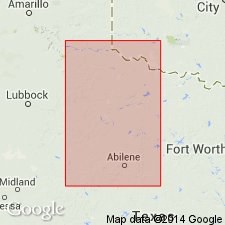
Area of report is central TX; in this area the Whitehorse Sandstone and Cloud Chief Gypsum are mapped undivided. Separately mapped units of Whitehorse and Cloud Chief include (ascending): Childress Dolomite, Eskota Gypsum, and Claytonville Dolomite. Childress Dolomite is present in Fisher and Nolan Cos, TX. Whitehorse, Cloud Chief, and Blaine (undivided) overlie Permian San Angelo Formation and underlie Permian Quartermaster Formation. Assigned to the Permian. Geologic map.
Source: GNU records (USGS DDS-6; Denver GNULEX).

- Usage in publication:
-
- Childress Dolomite [unranked]
- Modifications:
-
- Mapped 1:250k
- Dominant lithology:
-
- Dolomite
- AAPG geologic province:
-
- Palo Duro basin
- Permian basin
Summary:
Childress Dolomite [unranked] at base of Whitehorse Sandstone and Cloud Chief Gypsum [undifferentiated]. Forms scarp. Age is Permian.
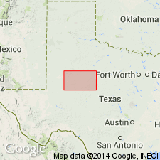
[Mapped in Cottle, King, and Stonewall Cos., TX.]
Source: Publication.
For more information, please contact Nancy Stamm, Geologic Names Committee Secretary.
Asterisk (*) indicates published by U.S. Geological Survey authors.
"No current usage" (†) implies that a name has been abandoned or has fallen into disuse. Former usage and, if known, replacement name given in parentheses ( ).
Slash (/) indicates name conflicts with nomenclatural guidelines (CSN, 1933; ACSN, 1961, 1970; NACSN, 1983, 2005, 2021). May be explained within brackets ([ ]).