

- Usage in publication:
-
- Chico Ridge limestone
- Modifications:
-
- Original reference
- Dominant lithology:
-
- Limestone
- AAPG geologic province:
-
- Fort Worth syncline
Summary:
Pg. 31. [Chico Ridge limestone in Graford formation.] The name Chico Ridge limestone is here given to thick limestone mass the outcrop of which forms the extensive upland known as Chico Ridge, south of Chico and north of Lake Bridgeport Dam. The limestone north of Trinity River interfingers laterally into the shales south of that stream. Two prominent tongues of the limestone (Rock Hill limestone at base and Devils Den limestone at top) are well developed south of the river. They thin to southwest, however, and lens out near Willow Point, Wise County, and Joplin, Jack County, respectively. To south of river the interval between Rock Hill and Devils Den limestones is filled with more than 300 feet of shales and sandstones, here named Jasper Creek shales, which are exact stratigraphic equivalents of Chico Ridge limestone north of river. Most of the limestone mass is white or gray, hard, and reef-like, but a small part of lower portion is dark and somewhat shaly. [Age is Pennsylvanian.]
Source: US geologic names lexicon (USGS Bull. 896, p. 428-429).

- Usage in publication:
-
- Chico Ridge Limestone
- Modifications:
-
- Mapped 1:250k
- Dominant lithology:
-
- Limestone
- AAPG geologic province:
-
- Fort Worth syncline
Summary:
Pamphlet [p. 14-15]. Chico Ridge Limestone of Canyon Group. Limestone with minor amounts of shale. Thickness 170 to 200 feet; thickens rapidly in subsurface to about 300 feet. Includes Devils Den Limestone Member at top and Rock Hill Limestone Member near base; both separately mapped. [See also entries under Devils Den and Rock Hill.] Intertongues with and in places overlies Jasper Creek Formation; lies above /Willow Point Formation and below Ventioner Formation; all of Canyon Group. Age is Late Pennsylvanian (Missourian).
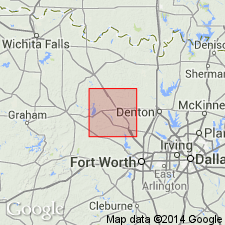
[Mapped in Lake Bridgeport area, Jack and Wise Cos., central northern TX; western edge of map sheet. Rocks previously (1967 ed. of map) mapped as Chico Ridge Limestone Member of Graford Formation. See also adjacent Wichita Falls-Lawton sheet, Texas Geol. Atlas, 1987.]
Source: Publication.
For more information, please contact Nancy Stamm, Geologic Names Committee Secretary.
Asterisk (*) indicates published by U.S. Geological Survey authors.
"No current usage" (†) implies that a name has been abandoned or has fallen into disuse. Former usage and, if known, replacement name given in parentheses ( ).
Slash (/) indicates name conflicts with nomenclatural guidelines (CSN, 1933; ACSN, 1961, 1970; NACSN, 1983, 2005, 2021). May be explained within brackets ([ ]).