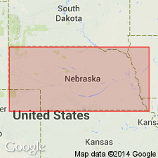
- Usage in publication:
-
- Chicago Mound formation
- Modifications:
-
- Original reference
- AAPG geologic province:
-
- Forest City basin
- Nemaha anticline
Summary:
Pg. 36 (fig. 14), 37. Chicago Mound formation. Name used for formation between West Branch shale above, and Towle shale below. Includes (ascending) Falls City limestone, Hawxby shale, and Aspinwall limestone. Thickness about 22 feet. Names Falls City, Hawxby, and Aspinwall were given for what were supposed to be members, but Moore ranked them on a cyclothemic basis as formations in Kansas. It is believed that they are members of a formation in Nebraska and Kansas, and formational name Chicago Mound is applied to them. Age is Permian (Big Blue).
Crops out in slopes and cuts along Highway 10, southeast of Chicago Mound, a well-known topographic feature southwest of Maple Hill, Wabaunsee Co., east-central KS.
Source: US geologic names lexicon (USGS Bull. 1200, p. 757-758).
For more information, please contact Nancy Stamm, Geologic Names Committee Secretary.
Asterisk (*) indicates published by U.S. Geological Survey authors.
"No current usage" (†) implies that a name has been abandoned or has fallen into disuse. Former usage and, if known, replacement name given in parentheses ( ).
Slash (/) indicates name conflicts with nomenclatural guidelines (CSN, 1933; ACSN, 1961, 1970; NACSN, 1983, 2005, 2021). May be explained within brackets ([ ]).

