

- Usage in publication:
-
- Chewacla dolomitic marble
- Modifications:
-
- Named
- Dominant lithology:
-
- Marble
- Dolomite
- AAPG geologic province:
-
- Piedmont-Blue Ridge province
Summary:
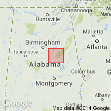
Chewacla dolomitic marble, introduced in this report, is a highly crystalline dolomite. Described as a beautiful pearly white stone. Occurs as a narrow northeast-southwest strip about 5 mi southeast from Opelika, Lee Co. Has been extensively quarried.
Source: GNU records (USGS DDS-6; Reston GNULEX).
- Usage in publication:
-
- Chewacla marble
- Modifications:
-
- Revised
- Age modified
- AAPG geologic province:
-
- Piedmont-Blue Ridge province
Summary:
Chewacla marble tentatively assigned to the Algonkian. [Because term "Algonkian system" has been discarded, this formation is classified by the U.S. Geological Survey as Precambrian.]
Source: GNU records (USGS DDS-6; Reston GNULEX).
- Usage in publication:
-
- Chewacla Marble
- Modifications:
-
- Revised
- AAPG geologic province:
-
- Piedmont-Blue Ridge province
Summary:
Chewacla Marble is an irregularly occurring dolomite unit within the Pine Mountain Group of Lee Co., AL. Unit is slightly metamorphosed. Varies from dense, fine-grained bluish dolomite to fine-grained buff dolomite. Locally phlogopite mica occurs along shear planes near the contact with the Hollis metaquartzite. Rock is highly siliceous at many places. Underlies Manchester Schist of Pine Mountain Group.
Source: GNU records (USGS DDS-6; Reston GNULEX).

- Usage in publication:
-
- Chewacla Marble*
- Modifications:
-
- Revised
- Areal extent
- AAPG geologic province:
-
- Piedmont-Blue Ridge province
Summary:
The Chewacla Marble is assigned to the Pine Mountain Group in the Pine Mountain anticlinorium in the Bill Arp thrust sheet in GA and AL. The Chewacla is a distinct mappable unit and is not a facies of the Manchester Schist as was proposed by Sears and others (1981). It overlies the Mountain Creek Formation of the Pine Mountain Group. Age is Late Proterozoic.
Source: GNU records (USGS DDS-6; Reston GNULEX).
- Usage in publication:
-
- Chewacla Marble*
- Modifications:
-
- Overview
- Age modified
- AAPG geologic province:
-
- Piedmont-Blue Ridge province
Summary:
In the Pine Mountain belt (Pine Mountain window), Middle Proterozoic basement rocks are represented by Wacoochee Complex and its components, Whatley Mill Gneiss and Halawaka Schist. Overlying early Paleozoic cover sequence is represented by Pine Mountain Group, which consists of (ascending) Hollis Quartzite, Manchester Schist, and Chewacla Marble (Bentley and Neathery, 1970; Sears and others, 1981; and Crickmay, 1952). Report includes geologic sketch map.
Source: GNU records (USGS DDS-6; Reston GNULEX).
For more information, please contact Nancy Stamm, Geologic Names Committee Secretary.
Asterisk (*) indicates published by U.S. Geological Survey authors.
"No current usage" (†) implies that a name has been abandoned or has fallen into disuse. Former usage and, if known, replacement name given in parentheses ( ).
Slash (/) indicates name conflicts with nomenclatural guidelines (CSN, 1933; ACSN, 1961, 1970; NACSN, 1983, 2005, 2021). May be explained within brackets ([ ]).