

- Usage in publication:
-
- Chetco Formation
- Modifications:
-
- Named
- Dominant lithology:
-
- Graywacke
- Mudstone
- AAPG geologic province:
-
- Klamath Mountains province
Summary:
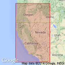
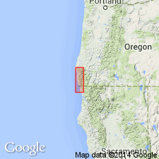
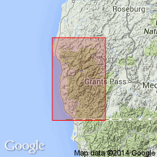
Report discusses west-central Klamath Mountains province, southwestern OR and northwestern CA. Chetco River and Chetco Peak are in Curry Co, OR. Name proposed for widespread and heterogeneous assemblage of rocks, predominantly graywacke and mudstone. Divisible into two members gradational with each other, Macklyn and Winchuck. Macklyn Member considered older though evidence not convincing. "Pistol River complex unit is believed to be either the most westerly part of the Chetco Formation or equivalent to the Rogue Formation of inland Oregon." Is in fault contact with Whalehead Formation (new). Chetco considered older than middle Portlandian and equivalent to Dothan Formation of southwestern OR and "Franciscan" Formation of northernmost CA on basis of lithologic similarity and regional continuity.
Source: GNU records (USGS DDS-6; Menlo GNULEX).
- Usage in publication:
-
- Chetco Formation
- Modifications:
-
- Not used
- AAPG geologic province:
-
- Klamath Mountains province
Summary:
[Although Chetco Formation is not mentioned in report] Widmier's (1963) Macklyn and Winchuck Members [of Chetco Formation] are described and mapped as members of Dothan Formation.
Source: GNU records (USGS DDS-6; Menlo GNULEX).
- Usage in publication:
-
- Chetco formation†
- Modifications:
-
- Abandoned
- AAPG geologic province:
-
- Klamath Mountains province
Summary:
Name "Chetco formation" (Widmier [1963]) abandoned because this complex assemblage is now recognized as part of Dothan formation. Names of members, Macklyn and Winchuck, retained as members of Dothan formation.
Source: GNU records (USGS DDS-6; Menlo GNULEX).
For more information, please contact Nancy Stamm, Geologic Names Committee Secretary.
Asterisk (*) indicates published by U.S. Geological Survey authors.
"No current usage" (†) implies that a name has been abandoned or has fallen into disuse. Former usage and, if known, replacement name given in parentheses ( ).
Slash (/) indicates name conflicts with nomenclatural guidelines (CSN, 1933; ACSN, 1961, 1970; NACSN, 1983, 2005, 2021). May be explained within brackets ([ ]).