

- Usage in publication:
-
- Chestnut sandstone member*
- Modifications:
-
- Original reference
- Dominant lithology:
-
- Sandstone
- AAPG geologic province:
-
- Appalachian basin
Summary:
Pg. 10. Chestnut sandstone member of Pottsville formation. Persistent quartzose sandstone, 100 feet thick, making Chestnut Ridge, and occurring in lower part of Pottsville formation in Cahaba coal field, central Alabama. Immediately overlies Gould group of coals. Age is Pennsylvanian.
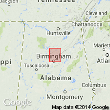
[Named from Chestnut Ridge, just northwest of the Cahaba River, Birmingham quadrangle, Jefferson Co., central AL.]
Source: US geologic names lexicon (USGS Bull. 896, p. 422).

- Usage in publication:
-
- Chestnut Sandstone Member*
- Modifications:
-
- Overview
- AAPG geologic province:
-
- Appalachian basin
Summary:
Pg. 31-32. Chestnut Sandstone Member of Pottsville Formation. A quartzose sandstone that makes a prominent ridge along the entire Cahaba coal field. The member is about 100 feet thick at the northern end and thickens to about 200 feet in the southern part of the coal field, where it contains a thick shale parting. Lies 500 to 800 feet above the Pine Sandstone Member and is above the Gould coal group. Present in Valley and Ridge province. [Age is Early Pennsylvanian (Morrowan).]
See also Charles Butts, 1910, USGS Geol. Atlas of the US, Birmingham folio, no. 175, p. 10; W.C. Culbertson, 1964, USGS Bull. 1182-B, p. B36, pl. 3.
Source: Publication.
For more information, please contact Nancy Stamm, Geologic Names Committee Secretary.
Asterisk (*) indicates published by U.S. Geological Survey authors.
"No current usage" (†) implies that a name has been abandoned or has fallen into disuse. Former usage and, if known, replacement name given in parentheses ( ).
Slash (/) indicates name conflicts with nomenclatural guidelines (CSN, 1933; ACSN, 1961, 1970; NACSN, 1983, 2005, 2021). May be explained within brackets ([ ]).