The National Geologic Map Database is migrating to a new infrastructure. We apologize for any service disruptions during this process.
|
|---|


- Usage in publication:
-
- Cheshire quartzite*
- Modifications:
-
- [Principal reference]
- Dominant lithology:
-
- Quartzite
- AAPG geologic province:
-
- New England province
Summary:
Pg. 32-34 and map. Cheshire quartzite. A granular quartz rock of very massive habit, rather fine and even grain, and colorless or slightly iron tinted. In places very feldspathic. Grades into underlying Dalton formation and is overlain by Stockbridge limestone. Shown as Lower Cambrian on map correlation chart. [This is present approved definition of Cheshire.]
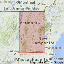
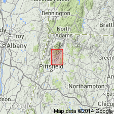
Probably named for typical exposures at or near Cheshire, Berkshire Co., western MA.
Source: US geologic names lexicon (USGS Bull. 896, p. 420); supplemental information from GNU records (USGS DDS-6; Reston GNULEX).
- Usage in publication:
-
- Cheshire quartzite
- Modifications:
-
- Revised
- AAPG geologic province:
-
- New England province
Summary:
In Green Mountains, westernmost nappe is made up of Cheshire quartzite, of Lower Cambrian age, infolded with a fine-grained graywacke, which has been traced from Essex Junction into southern Quebec, where it is known as Gilman "quartzite." In Vermont, this rock has been named Brigham Hill graywacke.
Source: US geologic names lexicon (USGS Bull. 1200, p. 479, 753).
- Usage in publication:
-
- Cheshire quartzite
- Modifications:
-
- Revised
- AAPG geologic province:
-
- New England province
Summary:
Pg. 100-101. Includes Brigham Hill graywacke phase.
Source: US geologic names lexicon (USGS Bull. 1200, p. 753).
- Usage in publication:
-
- Cheshire quartzite
- Modifications:
-
- Revised
- AAPG geologic province:
-
- New England province
Summary:
Pg. 649-666. Concluded that roots of Taconic thrust fault most probably lie between dolomite of Pico Peak series (new) and Cheshire quartzite.
Source: US geologic names lexicon (USGS Bull. 1200, p. 753).
- Usage in publication:
-
- Cheshire quartzite*
- Modifications:
-
- Overview
- AAPG geologic province:
-
- New England province
Summary:
Cheshire quartzite described as fine- to medium-grained, massive white quartzite grading downward into fissile muscovite quartzite; contains friable kaolinitized quartzite at its top. Crops out as a band around Hinsdale gneiss and Dalton formation on North Mountain. Underlies highest hills in southeast part of quad, including The Cobbles in town of Cheshire. Lower contact is gradational with Dalton; upper contact is marked by kaolinitized quartzite.
Source: GNU records (USGS DDS-6; Reston GNULEX).
- Usage in publication:
-
- Cheshire Quartzite*
- Modifications:
-
- Areal extent
- AAPG geologic province:
-
- New England province
Summary:
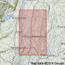
The correlation between the quartzite at Stissing Mountain, Dutchess County, New York, and quartzite at Poughquag [the Poughquag Quartzite] is much better supported than the correlation between quartzite at Stissing Mountain and quartzite of western Massachusetts [Cheshire Quartzite]. Therefore, the name Poughquag Quartzite is preferred rather than Cheshire Quartzite in eastern New York.
Source: GNU records (USGS DDS-6; Reston GNULEX).
- Usage in publication:
-
- Cheshire Quartzite*
- Modifications:
-
- Areal extent
- AAPG geologic province:
-
- New England province
Summary:
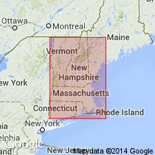
Rocks mapped as Cheshire Quartzite and Dalton Formation, undivided, are shown in figure 1 as present in Connecticut, thus extending the Cheshire from Masachusetts to Connecticut.
[GNU staff remark (1990): there seems to be some confusion as to the presence of Cheshire in CT. Harwood (1979) subsequently mapped in the same area in the South Sandisfield 7.5-min quad and shows no Cheshire in CT. Although Ratcliffe mapped the Ashley Falls quad to the immediate west, the map was never published and it may have shown Cheshire in CT. The only proof of Cheshire in CT found as of this date is on the overlapping parts of the Bedrock Geologic Map of Massachusetts by Zen and others (1983), and a very small part of Cheshire near the State border on the Bedrock Geologic Map of Connecticut by Rodgers (1985). No large-scale maps show Cheshire in CT.]
Source: GNU records (USGS DDS-6; Reston GNULEX).

- Usage in publication:
-
- Cheshire Quartzite*
- Modifications:
-
- Overview
- AAPG geologic province:
-
- New England province
Summary:
Used as Cheshire Quartzite of Early Cambrian age. Consists of white, massive, vitreous quartzite. Small part shown in adjacent area of northern Connecticut on this map. [See also entry for Cheshire under Ratcliffe and Harwood (1975).]
Source: GNU records (USGS DDS-6; Reston GNULEX).

- Usage in publication:
-
- Cheshire Quartzite*
- Modifications:
-
- Areal extent
- AAPG geologic province:
-
- New England province
Summary:
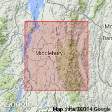
Stratigraphic succession in Middlebury synclinorium in north-central part of Glens Falls quadrangle consists of (ascending) Late Proterozoic Dalton Formation and Pinnacle Formation, Lower Cambrian Cheshire Quartzite, Lower and Middle Cambrian dolomites (Rutland Dolomite, Dunham Dolomite as used by Cady (1945), Winooski Dolomite) with minor quartzite (Monkton Formation), and Upper Cambrian Danby Formation. Middlebury synclinorium is considered a parautochthonous shelf sequence.
Source: GNU records (USGS DDS-6; Reston GNULEX).
- Usage in publication:
-
- Cheshire Quartzite
- Modifications:
-
- Overview
- AAPG geologic province:
-
- New England province
Summary:
Mapping in Bristol Notch and along the Green Mountain front indicate that the Cheshire Quartzite appears to be at least 2500 feet thick, which is about 2.5 times the original estimated thickness to the north and south. Near the base, the Cheshire is a massive argillaceous feldspathic meta-sandstone, containing recrystallized quartz and K-feldspar in a muscovite and biotite matrix. These lithologies grade upward through medium to thick-bedded schistose feldspathic meta-sandstones to clean, massive 'quartzites' of the Green Mountain front. Rocks currently mapped as the eastern-most Cheshire Quartzite probably belong to the Pinnacle Formation and are in fault contact with the Cheshire.
Source: GNU records (USGS DDS-6; Reston GNULEX).
For more information, please contact Nancy Stamm, Geologic Names Committee Secretary.
Asterisk (*) indicates published by U.S. Geological Survey authors.
"No current usage" (†) implies that a name has been abandoned or has fallen into disuse. Former usage and, if known, replacement name given in parentheses ( ).
Slash (/) indicates name conflicts with nomenclatural guidelines (CSN, 1933; ACSN, 1961, 1970; NACSN, 1983, 2005, 2021). May be explained within brackets ([ ]).