- Usage in publication:
-
- Cherryvale shales
- Modifications:
-
- Original reference
- Dominant lithology:
-
- Shale
- AAPG geologic province:
-
- Cherokee basin
Summary:
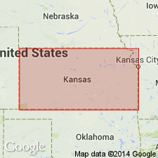
Pg. 47-48, 102. Cherryvale shales. Shales, 120 feet thick, prominent from Coffeyville almost to Neosho River. Overlie Mound Valley limestone and underlie Independence limestone. Age is Pennsylvanian.
Named from exposures in vicinity of Cherryvale, Montgomery Co., eastern KS.
Source: US geologic names lexicon (USGS Bull. 896, p. 418-419).
- Usage in publication:
-
- Cherryvale shales*
- Modifications:
-
- Revised
- AAPG geologic province:
-
- Cherokee basin
Summary:
Cherryvale shales. In southeastern Kansas underlies Drum limestone (= Independence limestone, preoccupied) and overlies Dennis limestone (= Mound Valley limestone). Thickness 120 feet (citing Haworth, 1898). Age is late Carboniferous.
Source: US geologic names lexicon (USGS Bull. 896, p. 418-419); supplemental information from GNU records (USGS DDS-6; Denver GNULEX).
- Usage in publication:
-
- Cherryvale shale
- Modifications:
-
- Revised
- AAPG geologic province:
-
- Cherokee basin
Summary:
Cherryvale shale. Underlies Drum limestone and overlies Dennis limestone. But Adams confused the Dennis with the older Mound Valley limestone, which underlies Galesburg shale. We retain Dennis for the upper limestone. Age is Pennsylvanian.
Source: US geologic names lexicon (USGS Bull. 896, p. 418-419).

- Usage in publication:
-
- Cherryvale shale*
- Modifications:
-
- Overview
- AAPG geologic province:
-
- Cherokee basin
Summary:
Pg. 418. In 1912 the equivalency of Independence limestone with Drum limestone was considered established, and Independence limestone was discarded for Drum by the USGS, and Winterset limestone was adopted (priority) for the limestone underlying the Cherryvale, its correlation with Dennis limestone being regarded as established. (See H. Hinds and F.C. Greene, Missouri Bur. Geol. and Mines, v. 13, 1915.) This definition of Cherryvale shale (as underlying Drum limestone and overlying Winterset limestone) was continued by the Kansas Geological Survey until 1932 (Kansas Geol. Soc. 6th Ann. Field Conf. Gdbk., Aug. 28 to Sept. 3), when R.C. Moore stated that the true Drum limestone is a higher limestone than the Drum of Hinds and Greene (= De Kalb limestone), and he included the De Kalb limestone in the Cherryvale shale. This definition of Cherryvale was adopted by Moore and G.E. Condra in their Oct. 1932 revised classification chart of the Pennsylvanian rocks of Kansas and Nebraska.
See also "Modern classifications of the Pennsylvanian rocks of eastern Kansas and southeastern Nebraska," compiled by M.G. Wilmarth, Secretary of Committee on Geologic Names, USGS unpub. corr. chart, Oct. 1936, 2 sheets.
Source: US geologic names lexicon (USGS Bull. 896, p. 418-419).
- Usage in publication:
-
- Cherryvale shale
- Modifications:
-
- Not used
- AAPG geologic province:
-
- Forest City basin
Summary:
Pg. 18, 34+. Cherryvale shale of southeastern Kansas underlies true Drum limestone and overlies Winterset limestone member of Dennis limestone. It corresponds to beds here named (descending) Quivira shale, Westerville limestone, Wea shale, Block limestone, and Fontana shale. The Drum limestone of Hinds and Greene at Kansas City is true Westerville, and their Cherryvale shale includes only Wea shale, Block Island limestone, and Fontana shale.
Source: US geologic names lexicon (USGS Bull. 896, p. 418-419); GNC KS-NE Pennsylvanian Corr. Chart, sheet 2, Oct. 1936.

- Usage in publication:
-
- Cherryvale shale
- Modifications:
-
- Overview
- AAPG geologic province:
-
- Cherokee basin
Summary:
Pg. 98. Type Cherryvale shale overlies Winterset limestone and underlies Drum limestone. It is 60 feet thick about 2 miles south of Cherryvale. It appears that Cherryvale shale of type region is very lenticular and that it is lower than other fairly thick shale and sandstone locally occurring above flaggy limestones and below Drum limestone. Correlation of Cherryvale shale with Fontana and other formations between Winterset and Drum limestones of Kansas City area is very uncertain. It is not advisable at present to use Cherryvale except in vicinity of Cherryvale. Age is Late Pennsylvanian (Missouri age). [On p. 45 Moore placed Cherryvale shale of "old classification" opposite Wea shale, Block limestone, and Fontana shale of "revised classification."]
Source: US geologic names lexicon (USGS Bull. 896, p. 418-419); GNC KS-NE Pennsylvanian Corr. Chart, sheet 2, Oct. 1936.
- Usage in publication:
-
- Cherryvale
- Modifications:
-
- Revised
- AAPG geologic province:
-
- Cherokee basin
Summary:
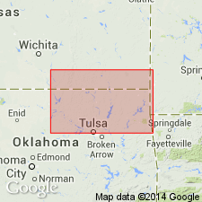
Pg. 40 (table), 42. Cherryvale shale. Included in Skiatook group. Occurs between Dennis limestone below and Drum (equivalent to Dewey) limestone above. Precisely equivalent to Nellie Bly formation (Gould, 1925, from unpub. ms. of D.W. Ohern) of northeastern Oklahoma, which by misunderstanding of section near Coffeyville was formerly thought to be an expansion of shale equivalent to part of Drum of Kansas. Thickness about 90 feet at Cherryvale; 10 feet or less west of Coffeyville; southward increases to about 125 feet east of Bartlesville and to more than 300 feet in latitude of Tulsa. Age is Late Pennsylvanian (Missourian).
Source: US geologic names lexicon (USGS Bull. 1200, p. 750-751).
- Usage in publication:
-
- Cherryvale shale
- Modifications:
-
- Revised
- AAPG geologic province:
-
- Forest City basin
Summary:
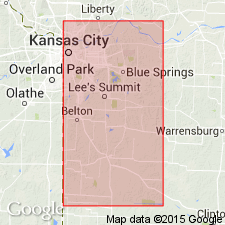
Pl. 1. Cherryvale shale of Kansas City group. Columnar section, Jackson and Cass Counties, Missouri, shows Cherryvale shale, in Kansas City group, comprises (ascending) Fontana shale, Block limestone, Wea shale, and Westerville limestone members. Overlies Dennis limestone; underlies Chanute shale. Age is Late Pennsylvanian (Missourian).
Source: US geologic names lexicon (USGS Bull. 1200, p. 750-751).
- Usage in publication:
-
- Cherryvale shale
- Modifications:
-
- Overview
- AAPG geologic province:
-
- Cherokee basin
Summary:
Pg. 191. Cherryvale shale. South of Linn County, where Westerville and Block limestones have not been identified, the interval between the Drum and Winterset limestones is known as Fontana-Quivira or Cherryvale shale. Near Cherryvale, unit comprises about 60 feet of bluish-gray silty shale containing layers of blue dense limestones near top. Age is Late Pennsylvanian (Missourian).
Source: US geologic names lexicon (USGS Bull. 1200, p. 750-751).
- Usage in publication:
-
- Cherryvale formation
- Cherryvale shale
- Modifications:
-
- Overview
Summary:
Pg. 2030, 2031 (fig. 4). Cherryvale formation (Cherryvale shale). In Kansas City group. At type locality, consists entirely of shale, but farther north there are persistent limestones (Block, Westerville) that extend into Iowa and Nebraska. Formation, as recognized by interstate agreement of Geological Surveys of Iowa, Kansas, Missouri, Nebraska, and Oklahoma, May 1947, comprises (ascending) Fontana shale, Block limestone, Wea shale, Westerville limestone, and Quivira shale members. Overlies Dennis formation; underlies Drum limestone. Classification of Missourian strata to northem Oklahoma diverges from interstate usage.
Source: US geologic names lexicon (USGS Bull. 1200, p. 750-751).
- Usage in publication:
-
- Cherryvale formation
- Modifications:
-
- Areal extent
- AAPG geologic province:
-
- Iowa shelf
- Forest City basin
Summary:
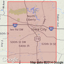
Pg. 418 (fig. 1), 420-421. Cherryvale formation of Kansas City group. Thickness of formation about 24.5 feet in Madison and Adair Counties, Iowa. Comprises (ascending) Wea-Fontana members, Westerville limestone, and Quivira shale members. Overlies Dennis formation; underlies Drum formation. Age is Late Pennsylvanian (Missourian).
Source: US geologic names lexicon (USGS Bull. 1200, p. 750-751).
- Usage in publication:
-
- Cherryvale formation
- Modifications:
-
- Areal extent
- AAPG geologic province:
-
- Iowa shelf
- Forest City basin
Summary:
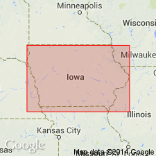
Pg. 27, fig. 5. Cherryvale formation (Cherryvale shale). Comprises (ascending) Fontana shale, Block limestone, and Wea shale members. Members not differentiated in Madison County but tentatively identified in Crescent quarry, Pottawatamie County. Formation in Madison County consists of thinly bedded dark-gray shale with several thin beds of dense dark-blue-gray fossiliferous limestone. DERBYIA and CHONETES abundant, latter occurring to such large numbers as to form thin coquina-like zones. Thickness about 9 feet. Underlies Westerville limestone; overlies Dennis limestone. Age is Late Pennsylvanian (Missourian).
Source: US geologic names lexicon (USGS Bull. 1200, p. 751).
For more information, please contact Nancy Stamm, Geologic Names Committee Secretary.
Asterisk (*) indicates published by U.S. Geological Survey authors.
"No current usage" (†) implies that a name has been abandoned or has fallen into disuse. Former usage and, if known, replacement name given in parentheses ( ).
Slash (/) indicates name conflicts with nomenclatural guidelines (CSN, 1933; ACSN, 1961, 1970; NACSN, 1983, 2005, 2021). May be explained within brackets ([ ]).

