- Usage in publication:
-
- Cherry Point silt
- Modifications:
-
- Original reference
- Dominant lithology:
-
- Clay
- Silt
- AAPG geologic province:
-
- Bellingham basin
Summary:
Pg. 1469 (table 1), 1470, pl. 3; 1963, Dissert. Abs., v. 23, no. 8, p. 2873. Cherry Point silt. Formal proposal of name. Consists of blue to brownish-gray well-stratified clay with marine fossils at several localities. Base of unit not exposed; maximum exposed thickness is 140 feet in sea cliffs and 300 feet in nearby wells. At type section[!] unconformably underlies Mountain View sand and gravel which is overlain by Vashon till and glaciomarine drift. To north sand and gravel wedge out so till and glaciomarine drift lies directly on Cherry Point silt. To south sand and gravels thicken and contact with Cherry Point descends below sea level. Shown on sketch map of northern Puget Lowland as Cherry Point formation. Age is considered late Pleistocene. Shells from upper portion of unit yielded radiocarbon age of older than 38,000 yr B.P. [Called "Cherry Point Clay" in PhD thesis.]
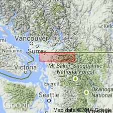
Type locality: Cherry Point on Strait of Georgia, northern Puget Lowland, northwestern WA. Outcrops restricted to sea cliffs along Strait of Georgia, near type locality, but unit probably continuous beneath upland to the east. Named from Cherry Point [Lat. 48 deg. 51 min. 42 sec. N., Long. 122 deg. 44 min. 54 sec. W., Lummi Bay 7.5-min quadrangle, Whatcom Co., northwestern WA (from USGS GNIS database, accessed October 1, 2011)].
Source: US geologic names lexicon (USGS Bull. 1350, p. 146); GNU records (USGS DDS-6; Menlo GNULEX).
For more information, please contact Nancy Stamm, Geologic Names Committee Secretary.
Asterisk (*) indicates published by U.S. Geological Survey authors.
"No current usage" (†) implies that a name has been abandoned or has fallen into disuse. Former usage and, if known, replacement name given in parentheses ( ).
Slash (/) indicates name conflicts with nomenclatural guidelines (CSN, 1933; ACSN, 1961, 1970; NACSN, 1983, 2005, 2021). May be explained within brackets ([ ]).

