- Usage in publication:
-
- Cherry Brook Formation*
- Modifications:
-
- Named
- Dominant lithology:
-
- Amphibolite
- Volcanics
- Tuff
- Schist
- Quartzite
- AAPG geologic province:
-
- New England province
Summary:
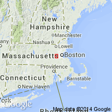
Named for Cherry Brook, Concord quad, Middlesex Co., eastern MA. Previously mapped as part of the Marlboro Formation, but detailed mapping shows no correlation of these rocks to rocks of Marlboro type locality. Occurs along Merriam Street at Cherry Brook (type locality), elsewhere along Merriam Street, on small hills east of Merriam Street, and north of railroad in adjacent Natick quad. Felsic volcanic rocks may be seen along railroad about 0.6 mi (0.96 km) east of Merriam Street in Natick quad. Lower part consists of light- to pinkish-gray, fine- to medium-grained biotite-quartz-feldspar schist with a few thin beds of dark, medium-grained biotite-quartz-feldspar schist. Upper part consists predominantly of equigranular to inequigranular, fine- to coarse-grained, thin- to thick-layered amphibolite and intercalated biotite schist and quartzite. Amphibolite is locally striped with thin, alternating, discontinuous felsic and mafic bands. Some exposures are massive and amygdaloidal; some show vague pillow structure. In Natick quad, Cherry Brook consists of a thick sequence of volcanic tuffs and flows. Thickness ranges from 900 m in Natick quad to more than 1200 m in adjacent Concord quad. Unconformably underlies Claypit Hill Formation (new); overlies Kendal Green Formation (revised). Age is uncertain, but is shown in figures as Precambrian Z and early Paleozoic.
Source: GNU records (USGS DDS-6; Reston GNULEX).

- Usage in publication:
-
- Cherry Brook Formation
- Modifications:
-
- Not used
- AAPG geologic province:
-
- New England province
Summary:
Not shown on MA State Geologic Map. [Usage still good.]
Source: GNU records (USGS DDS-6; Reston GNULEX).

- Usage in publication:
-
- Cherry Brook Formation
- Modifications:
-
- Not used
- AAPG geologic province:
-
- New England province
Summary:
Rocks mapped as Cherry Brook Formation by Nelson (1974) are included in a Proterozoic Z unnamed unit of metamorphosed mafic to felsic flow, volcaniclastic, and hypabyssal intrusive rocks. [Cherry Brook still a valid term; not abandoned. Chapters A-J in U.S. Geological Survey Professional Paper 1366 are intended as explanations and (or) revisions to 1:250,000-scale MA State bedrock geologic map of Zen and others (1983).]
Source: GNU records (USGS DDS-6; Reston GNULEX).
For more information, please contact Nancy Stamm, Geologic Names Committee Secretary.
Asterisk (*) indicates published by U.S. Geological Survey authors.
"No current usage" (†) implies that a name has been abandoned or has fallen into disuse. Former usage and, if known, replacement name given in parentheses ( ).
Slash (/) indicates name conflicts with nomenclatural guidelines (CSN, 1933; ACSN, 1961, 1970; NACSN, 1983, 2005, 2021). May be explained within brackets ([ ]).

