The National Geologic Map Database is migrating to a new infrastructure. We apologize for any service disruptions during this process.
|
|---|


- Usage in publication:
-
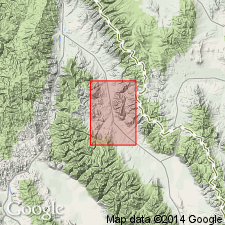
- Cheney Volcanics
- Modifications:
-
- Named
- Dominant lithology:
-
- Latite
- Andesite
- Rhyolite
- AAPG geologic province:
-
- Idaho Mountains province
Summary:
Named as lower unit of Challis Volcanic Group (rank raised) after Cheney Creek, Salmon quad, Lemhi Co, ID in the Idaho Mountains province. No type locality designated. Widely distributed in southwest and northwest part of Lemhi quad. Geologic map and cross sections. Consists of light colored latitic and andesitic flows and flow breccias. Surfaces have a sparkly appearance due to presence of crystals of andesine. Locally includes rhyolite flows and ignimbrites, and tuffaceous rocks. Thickness is probably in excess of 2,000 ft. Some flows may be several hundred ft thick. Total thickness not easily determined because of faulting. Are older than Yearian Volcanics (new) of Challis. Probably equivalent to Cook Ranch Formation of MT. Of middle Oligocene age.
Source: GNU records (USGS DDS-6; Denver GNULEX).
For more information, please contact Nancy Stamm, Geologic Names Committee Secretary.
Asterisk (*) indicates published by U.S. Geological Survey authors.
"No current usage" (†) implies that a name has been abandoned or has fallen into disuse. Former usage and, if known, replacement name given in parentheses ( ).
Slash (/) indicates name conflicts with nomenclatural guidelines (CSN, 1933; ACSN, 1961, 1970; NACSN, 1983, 2005, 2021). May be explained within brackets ([ ]).