The National Geologic Map Database is migrating to a new infrastructure. We apologize for any service disruptions during this process.
|
|---|


- Usage in publication:
-
- Chena Alluvium*
- Modifications:
-
- Named
- Dominant lithology:
-
- Silt
- Sand
- AAPG geologic province:
-
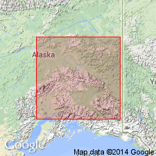
- Alaska East-Central region
Summary:
Named for exposures in flood plain of Chena River at Fairbanks. Type section designated as subsurface exposures in 15-cm-diameter water well (U.S. Smelting, Refining, and Mining Co. Well B) at 510 Illinois Street, in SW/4 sec.3 T1S R1W, Fairbanks D-2 quad, AK. Consists of alternating lenses and layers of well-sorted river silt, sand, and gravel, including glacial outwash deposits. Thickness ranges from a few meters to more than 100 m in major rivers. Unconformably overlies Cripple Gravel, Tanana Formation (both new), or bedrock. Assigned Pleistocene and Holocene (Illinoian(?) to Holocene) age.
Source: GNU records (USGS DDS-6; Menlo GNULEX).
For more information, please contact Nancy Stamm, Geologic Names Committee Secretary.
Asterisk (*) indicates published by U.S. Geological Survey authors.
"No current usage" (†) implies that a name has been abandoned or has fallen into disuse. Former usage and, if known, replacement name given in parentheses ( ).
Slash (/) indicates name conflicts with nomenclatural guidelines (CSN, 1933; ACSN, 1961, 1970; NACSN, 1983, 2005, 2021). May be explained within brackets ([ ]).