The National Geologic Map Database is migrating to a new infrastructure. We apologize for any service disruptions during this process.
|
|---|


- Usage in publication:
-
- Chemehuevis gravel
- Modifications:
-
- Original reference
- Dominant lithology:
-
- Gravel
- AAPG geologic province:
-
- Plateau sedimentary province
Summary:
Pg. 18. Chemehuevis gravel. A series of unconsolidated gravels that lie unconformably on Temple Bar conglomerate in terraced bluffs along Colorado River from Grand Canyon to the Gulf. Thickness 700+/- feet maximum. Occupy a measurably narrow belt along the river, having been deposited as valley filling during an aggrading stage of Colorado River. Age is "probable" late Quaternary [Pleistocene] based on the unconformable relations with the Temple Bar conglomerate, and unconsolidated condition of both the Temple Bar and Chemehuevis.
Named from Chemehuevis [now spelled without the final s] Valley, south of the Needles, western AZ.
Source: US geologic names lexicon (USGS Bull. 896, p. 410-411); supplemental information from GNU records (USGS DDS-6; Denver GNULEX).
- Usage in publication:
-
- Chemehuevis formation
- Modifications:
-
- Areal extent
- Dominant lithology:
-
- Sand
- Silt
- Clay
- AAPG geologic province:
-
- Plateau sedimentary province
Summary:
Pg. 1443-1450. Chemehuevis formation. Consists chiefly of sand, silt, and clay. Strongly unconformable on the old river gravels. Measured section 450 feet thick described. Age is probably Pleistocene.
Source: US geologic names lexicon (USGS Bull. 1200, p. 742); supplemental information from GNU records (USGS DDS-6; Denver GNULEX).
- Usage in publication:
-
- Chemehuevi formation
- Modifications:
-
- Areal extent
Summary:
Pg. 820 (fig. 2), 827. Chemehuevi formation. Although sediments are unconsolidated and easily eroded, hundreds of remnants lie at various levels along the valley below the Grand Canyon. [Age is Pleistocene]
Source: US geologic names lexicon (USGS Bull. 1200, p. 742).
- Usage in publication:
-
- Chemehuevi formation*
- Modifications:
-
- Overview
- AAPG geologic province:
-
- Great Basin province
- Plateau sedimentary province
Summary:
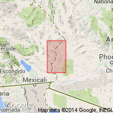
Remnants of the deposits of the Chemehuevi are lacustrine in origin, rather than deposits left by the Colorado River as Lee (1908) thought. The gravels in the Chemehuevi represent incipient lake deposits. The characteristic lake deposits are clay in thin laminae. The sand in the upper part of the formation was probably deposited as sand of the topset and foreset beds of a delta. Cross sections. The lake was probably deep and fed by a large permanent stream. Remnants are found along lower parts of the Colorado River and to a height 300 ft above the river. The lake is speculated as being nearly 1,000 ft deep near the present Davis Dam and 9 to 10 mi wide in the valley south of Mount Davis. Mammal bones and mollusks fossils found. Mapped as a Pleistocene unit and part of the Quaternary alluvium and lake deposits. Probably occurs in the Clark Co, NV, Great Basin province area and in Mohave Co, AZ in the Plateau sedimentary province area.
Source: GNU records (USGS DDS-6; Denver GNULEX).
- Usage in publication:
-
- Chemehuevi Formation*
- Modifications:
-
- Redescribed
- Areal extent
- AAPG geologic province:
-
- Basin-and-Range province
- Mojave basin
- Plateau sedimentary province
- Salton basin
Summary:
Chemehuevi Formation is redescribed as mostly sand and silt with some gravel. Age is Pleistocene.
Source: GNU records (USGS DDS-6; Menlo GNULEX).
- Usage in publication:
-
- Chemehuevi Formation*
- Modifications:
-
- Principal reference
- AAPG geologic province:
-
- Plateau sedimentary province
Summary:
Chemehuevi Formation. Consists mainly of mud and sand facies. Includes tephra layers, notably the Monkey Rock tephra bed. Exposed thickness 10 to 140 m. Unconformably overlies Proterozoic granite. In a number of places, unconformably underlies Colorado River fluvial terraces and scarps. Age is late Pleistocene, based on isotope analyses and fossils.
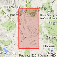
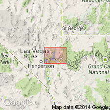
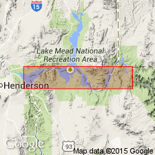
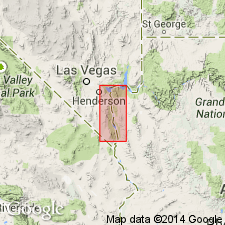
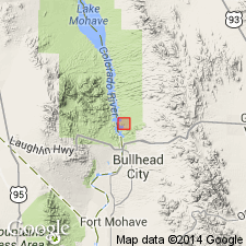
Type section: exposed at Loaf Rock hill near the Katherine Ranger Station in Lake Mead National Recreation Area, adjacent to Lake Mohave, in NW/4 sec. 7, T. 21 N., R. 21 W., [Lat. 35 deg. 13 min. 26 sec. N., Long. 114 deg. 33 min. 59 sec. W.], Davis Dam 7.5-min quadrangle, [Mohave Co.], western AZ.
Reference sections: (1) Katherine Landing, about 0.5 km southwest of type section, in NW/4 sec. 7, T. 21 N., R. 21 W., [approx. Lat. 35 deg. 13 min. 12 sec. N., Long. 114 deg. 34 min. 14 sec. W., Davis Dam 7.5-min quadrangle, Mohave Co., western AZ]; (2) old Calville outcrop as described by Longwell (1936, p. 1445-1446), [Sandy Cove area, north shore of Lake Mead, in NE/4 sec. 13, T. 21 S., R. 65 E., approx. Lat. 36 deg. 08 min. 15 sec. N., Long. 114 deg. 40 min. W., Callville Bay 7.5-min quadrangle (1983 prov. ed.), Clark Co., southeastern NV].
[Additional locality information from USGS historical topographic map collection TopoView, USGS GNIS database, Montana State Univ. Graphical Locator, ACME Mapper 2.0; accessed March 8, 2012.]
Source: Publication.
For more information, please contact Nancy Stamm, Geologic Names Committee Secretary.
Asterisk (*) indicates published by U.S. Geological Survey authors.
"No current usage" (†) implies that a name has been abandoned or has fallen into disuse. Former usage and, if known, replacement name given in parentheses ( ).
Slash (/) indicates name conflicts with nomenclatural guidelines (CSN, 1933; ACSN, 1961, 1970; NACSN, 1983, 2005, 2021). May be explained within brackets ([ ]).