- Usage in publication:
-
- Chavez Canyon Member
- Modifications:
-
- Named
- Dominant lithology:
-
- Sandstone
- Conglomerate
- AAPG geologic province:
-
- Orogrande basin
Summary:
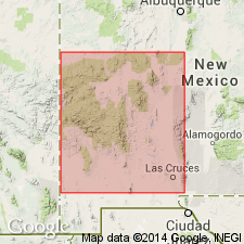
Named as middle member of Spears Formation of Datil Group for Chavez well. Type section located 17 mi northeast of Datil and 0.6 mi north of Chavez well, S1/2 sec 27, T2N, R8W, northwest Gallinas Mountains, Socorro Co, NM, Orogrande basin. Also known in Datil Mountains. Consists of a lower feldspathic sandstone (175-200 ft thick) and an overlying conglomeratic unit. Includes minor debris flows. Quartz scarce throughout. Almost all clasts are volcanics. Transport directions are to north and northeast. Ranges from 250 to 300 ft thick. Overlies Dog Springs Member (new) of Spears. Underlies Rock House Canyon Tuff (new). Locally split by Datil Well Tuff. Has not been dated. Assigned to Oligocene.
Source: GNU records (USGS DDS-6; Denver GNULEX).
For more information, please contact Nancy Stamm, Geologic Names Committee Secretary.
Asterisk (*) indicates published by U.S. Geological Survey authors.
"No current usage" (†) implies that a name has been abandoned or has fallen into disuse. Former usage and, if known, replacement name given in parentheses ( ).
Slash (/) indicates name conflicts with nomenclatural guidelines (CSN, 1933; ACSN, 1961, 1970; NACSN, 1983, 2005, 2021). May be explained within brackets ([ ]).

