The National Geologic Map Database is migrating to a new infrastructure. We apologize for any service disruptions during this process.
|
|---|


- Usage in publication:
-
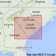
- Chauga River zone
- Modifications:
-
- Named
- Dominant lithology:
-
- Schist
- Slate
- Limestone
- AAPG geologic province:
-
- Piedmont-Blue Ridge province
Summary:
Named for Chauga River, Oconee Co., northwestern SC. Comprises a narrow band bounded on the northwest by Chattooga zone and on the southeast by a line extending from near a point where Toxaway River enters SC to Tugaloo River, slightly below its confluence with Brasstown Creek. Consists of fine-grained, dark, shimmering quartz schist, mica schists, graphite slates, limestones, and other rock types. Probably corresponds to A. Keith's "Brevard Schist", assigned to Cambrian. Age is Cambrian(?).
Source: GNU records (USGS DDS-6; Reston GNULEX).
For more information, please contact Nancy Stamm, Geologic Names Committee Secretary.
Asterisk (*) indicates published by U.S. Geological Survey authors.
"No current usage" (†) implies that a name has been abandoned or has fallen into disuse. Former usage and, if known, replacement name given in parentheses ( ).
Slash (/) indicates name conflicts with nomenclatural guidelines (CSN, 1933; ACSN, 1961, 1970; NACSN, 1983, 2005, 2021). May be explained within brackets ([ ]).