The National Geologic Map Database is migrating to a new infrastructure. We apologize for any service disruptions during this process.
|
|---|


- Usage in publication:
-
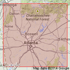
- Chattahoochee Palisades Quartzite*
- Modifications:
-
- Named
- Dominant lithology:
-
- Quartzite
- Schist
- AAPG geologic province:
-
- Piedmont-Blue Ridge province
Summary:
Named for the Palisades of the Chattahoochee River in Chattahoochee Palisades State Park, GA, where it forms cliff outcrops. Mapped as the lower quartzite unit of Higgins (1968). Consists of massive white, yellowish, or bluish, sugary to vitreous quartzite containing accessory mica and elongated garnets. Locally shows graded bedding, but beds are also commonly interlayered with feldspathic quartzite and muscovite schist. Along strike, variations to quartzose mica schist are seen that are due to sedimentary facies changes. Bottom of quartzite is in sharp, possibly unconformable contact with underlying Powers Ferry Formation. Top grades into Factory Shoals Formation. Based on geologic mapping, quartzite is about 100 m (329 ft) thick. Locally absent due to nondeposition. Age is late Precambrian and (or) early Paleozoic.
Source: GNU records (USGS DDS-6; Reston GNULEX).

- Usage in publication:
-
- Chattahoochee Palisades Quartzite*
- Modifications:
-
- Revised
- Age modified
- AAPG geologic province:
-
- Piedmont-Blue Ridge province
Summary:
Recent mapping shows that rocks mapped as Rottenwood Creek Quartzite, Lanier Mountain Quartzite Member of the Snellville Formation, part of the Andy Mountain Formation, and part of the Tallulah Falls Formation belong to the Chattahoochee Palisades Quartzite of the Sandy Springs Group in the Sandy Springs thrust sheet in GA and AL. The Tallulah Falls is geographically restricted from this area and the other units are here abandoned. The age of the Chattahoochee Palisades is Late Proterozoic to Early Ordovician(?).
Source: GNU records (USGS DDS-6; Reston GNULEX).
- Usage in publication:
-
- Chattahoochee Palisades Quartzite
- Modifications:
-
- Revised
- AAPG geologic province:
-
- Piedmont-Blue Ridge province
Summary:
Lithologic units that compose the Jacksons Gap Group do not disappear beneath the Coastal Plain as previously thought, but can be mapped eastward around the hinge zone of the Tallassee synform where along the eastern limb they become the Loachapoka Schist of the Opelika Complex. The Loachapoka continues along the east limb of the synform into GA where it corresponds to the Sandy Springs thrust sheet of Higgins and others (1988). The Saugahatchee quartzite of the Loachapoka Schist, the Tallassee and Devils Backbone quartzites of the Jacksons Gap Group, and the Chattahoochee Palisades Quartzite are correlative. Authors suggest that the name Chattahoochee Palisades Quartzite be applied to these quartzites and further recommend that the schists of the Loachapoka and Jacksons Gap Group be referred to as the Factory Shoals Formation of the Sandy Springs Group.
Source: GNU records (USGS DDS-6; Reston GNULEX).

- Usage in publication:
-
- Chattahoochee Palisades Quartzite*
- Modifications:
-
- Revised
- Age modified
- AAPG geologic province:
-
- Piedmont-Blue Ridge province
Summary:
Detailed mapping of Sandy Springs Group in its type area during 1990-1993 indicates that rocks are a sequence of fault slices that mimic true stratigraphy, rather than a stratigraphic sequence. Revised sequence consists of 1) aluminous schist unit containing one or more unnamed quartzites and local metagraywacke, 2) Chattahoochee Palisades Quartzite, and 3) unnamed garnetiferous schist unit. It is not known if unnamed quartzites in aluminous schist unit are Chattahoochee Palisades Quartzite. Chattahoochee Palisades Quartzite appears to everywhere overlie aluminous schist unit and is probably in stratigraphic contact with it. Powers Ferry Formation is actually a facies of Stonewall Gneiss (revised) and is therefore removed from Sandy Springs Group and assigned as Powers Ferry Member of Stonewall Gneiss. Factory Shoals Formation cannot be mapped away from its type locality; it is herein abandoned and its rocks reassigned to aluminous schist unit. Age is changed to Late Proterozoic to Middle Ordovician in accordance with age change for all cover sequence rocks of the area. Detrital zircons in Chattahoochee Palisades Quartzite yielded Pb-U ages consistent with an age of about 1.1 to 1 Ga; this provides a maximum age for the unit. Report includes geologic map and correlation chart.
Source: GNU records (USGS DDS-6; Reston GNULEX).
For more information, please contact Nancy Stamm, Geologic Names Committee Secretary.
Asterisk (*) indicates published by U.S. Geological Survey authors.
"No current usage" (†) implies that a name has been abandoned or has fallen into disuse. Former usage and, if known, replacement name given in parentheses ( ).
Slash (/) indicates name conflicts with nomenclatural guidelines (CSN, 1933; ACSN, 1961, 1970; NACSN, 1983, 2005, 2021). May be explained within brackets ([ ]).