The National Geologic Map Database is migrating to a new infrastructure. We apologize for any service disruptions during this process.
|
|---|


- Usage in publication:
-
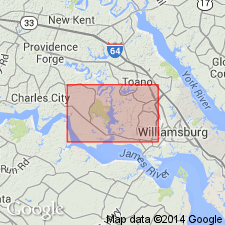
- Charles City Formation
- Modifications:
-
- Named
- Dominant lithology:
-
- Sand
- AAPG geologic province:
-
- Atlantic Coast basin
Summary:
Charles City Formation, here named in Charles City Co., southeastern VA, is an upward-fining sequence of gravelly sand and silty to clayey sand. Strata was previously described as the Wicomico Formation (Wentworth, 1930). It is mapped along the streams of the middle Coastal Plain. Composed of a lower interbedded pebbly-sand and coarse- and medium-grained sand, about 30 ft thick and an upper fine sandy or clayey silt. Total thickness of formation at the type section is 65.1 ft. Unit is surficial formation under the Grove plain and elsewhere underlies the middle Pleistocene Chuckatuck Formation (new name). Disconformably overlies the early Pleistocene Windsor Formation. Early Pleistocene age assignment is based on stratigraphic position.
Source: GNU records (USGS DDS-6; Reston GNULEX).
- Usage in publication:
-
- Charles City Formation*
- Modifications:
-
- Overview
- AAPG geologic province:
-
- Atlantic Coast basin
Summary:
Charles City Formation mapped in the Coastal Plain of southeastern VA. Overlies Windsor Formation; underlies Chuckatuck Formation. Age is early Pleistocene.
Source: GNU records (USGS DDS-6; Reston GNULEX).

- Usage in publication:
-
- Charles City Formation
- Modifications:
-
- Overview
- AAPG geologic province:
-
- Atlantic Coast basin
Summary:
Nomenclature on State map follows Johnson and Berquist (1989). Unit described as light- to medium-gray and light- to dark-yellowish and reddish-brown sand, silt, and clay that compose surficial deposits of riverine terraces and coast-parallel plains at altitudes of 70 to 80 ft. Unit is adjacent to and inset below, the Windsor Formation and older deposits. Bay or shallow-shelf facies of the Charles City, present beneath flat to gently seaward-sloping plain in Suffolk area, includes a thin, basal, gravelly sand grading upward into fine- to medium-grained sand and an uppermost clayey and sandy silt; lower and middle parts of unit contain clay-lined, sand-filled burrows. Fluvial-estuarine facies in terrace remnants along major rivers consists of cross-bedded gravelly sand and clayey silt. Thickness ranges from 0 to 55 ft or more. Age is early Pleistocene(?).
Source: GNU records (USGS DDS-6; Reston GNULEX).
For more information, please contact Nancy Stamm, Geologic Names Committee Secretary.
Asterisk (*) indicates published by U.S. Geological Survey authors.
"No current usage" (†) implies that a name has been abandoned or has fallen into disuse. Former usage and, if known, replacement name given in parentheses ( ).
Slash (/) indicates name conflicts with nomenclatural guidelines (CSN, 1933; ACSN, 1961, 1970; NACSN, 1983, 2005, 2021). May be explained within brackets ([ ]).