

- Usage in publication:
-
- Chappo Member*
- Modifications:
-
- Named
- Dominant lithology:
-
- Mudstone
- Sandstone
- Siltstone
- Conglomerate
- AAPG geologic province:
-
- Green River basin
Summary:
Chappo Member of Wasatch Formation. Name proposed for the lower of three units previously called "main body of Wasatch Formation." Member is brightly colored. Composed of: predominantly red, maroon, reddish-brown, ocher, tan, and gray mudstone; abundant white, tan, brown, gray, and red sandstone and siltstone; abundant gray, brown, and red conglomerate (derived from nearby Paleozoic and Mesozoic formations); and some pisolitic limestone at most localities (pisolites usually less than 1 inch, but may be up to 5 inches across). Thickness is 490+ feet at type [section]; 680+ feet at Buckman Hollow, section incomplete; thicker in subsurface (1,200 feet in well in study area). May thicken eastward to as much as 2,000 feet. Unconformably underlies La Barge Member (new) of Wasatch Formation. Rests directly on Paleozoic and Mesozoic rocks. Vertebrates and mollusks identified are of latest Paleocene (Clarkfork) and earliest Eocene (Graybull). Names Almy and Knight not applicable to rocks in this area.
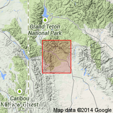
Type area: near Hogsback ridge, north of La Barge Creek, extends from Buckman Hollow eastward to exposures in Chappo Gulch, 1 mi southeast of Salli mine. Named from Chappo Gulch.
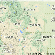
Type section (incomplete): in NE/4 sec. 17, T. 26 N., R. 113 W., at Chappo Creek, Lincoln Co., southwestern WY (Greater Green River basin).
Reference section [incomplete]: in Buckman Hollow, sec. 12, T. 26 N., R. 114 W., Lincoln Co., southwestern WY (Greater Green River basin).
Source: US geologic names lexicon (USGS Bull. 1350, p. 143-144): supplemental information from GNU records (USGS DDS-6; Denver GNULEX).
- Usage in publication:
-
- Chappo Member
- Modifications:
-
- Revised
- AAPG geologic province:
-
- Green River basin
Summary:
zzzzzChappo Member of Wasatch Formation. In central part of Hoback basin, the Hoback Formation is restricted to the lower 2,000 feet. The upper 600 +/-m [or the upper 2,600 m?] removed from the Hoback is allocated to the Chappo Member of the Wasatch Formation. Mapped from north of Hoback River to Dell Creek, in Sublette County, Wyoming (Greater Green River basin); see geologic map. Composed of: variegated (gray, tan, white, red) sandstone; tan, gray, red, pink, and brown shale; siltstone; gray, tan, and red conglomerate; and gray pisolitic limestone containing charophyte algae and gastropod shells (limestone makes up less than 1 percent of member). Red color inherited from Triassic rocks. In southwest corner of basin, Chappo deposited in an alluvial-plain setting (distal-fan or braided-stream deposits); basinward Chappo deposited in alluvial-plain and flood-plain settings (pebble size decreases, sandstone decreases, and limestone increases). Pebble size and direction of crossbed dip indicates sediments were transported from the southwest to the northeast. Chappo is equivalent to part of Lookout Mountain Conglomerate Member (new) of the Wasatch. Intertongues with the underlying Hoback and the overlying and partly equivalent Pass Peak. Age is earliest Eocene (early Wasatchian-Graybullian or Clarkforkian), based on vertebrate fauna (mammals). Report includes geologic map.
[Discrepancy in GNU records concerning thickness of rocks allocated to Chappo Member. --unresolved.]
Source: Modified from GNU records (USGS DDS-6; Denver GNULEX).
For more information, please contact Nancy Stamm, Geologic Names Committee Secretary.
Asterisk (*) indicates published by U.S. Geological Survey authors.
"No current usage" (†) implies that a name has been abandoned or has fallen into disuse. Former usage and, if known, replacement name given in parentheses ( ).
Slash (/) indicates name conflicts with nomenclatural guidelines (CSN, 1933; ACSN, 1961, 1970; NACSN, 1983, 2005, 2021). May be explained within brackets ([ ]).