The National Geologic Map Database is migrating to a new infrastructure. We apologize for any service disruptions during this process.
|
|---|


- Usage in publication:
-
- Chappel formation
- Modifications:
-
- Original reference
- Dominant lithology:
-
- Limestone
- AAPG geologic province:
-
- Llano uplift
Summary:
Pg. 91-92, 96. Chappel formation. A thin limestone of Boone or Osage age here named Chappel formation. Known maximum thickness in surface exposures only a few feet. Underground to the north and west of Llano uplift it is absent or ranges in thickness up to 150 feet. Is hard, medium dark, abounds in crinoid fragments. Rests disconformably on Ellenburger (Ordovician) limestone and disconformably underlies Barnett (Mississippian) formation. Lowermost part contains, according to Goldman, as inclusions, small pellets of Ellenburger limestone. Age is Mississippian.
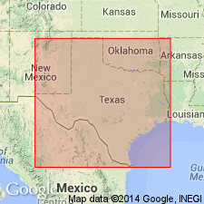
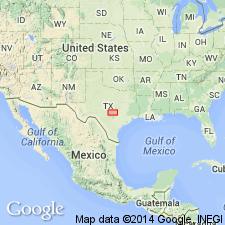
Type locality: 3 mi southeast of San Saba, central TX. [Geographic feature not mentioned, but there is a village called Chappel southeast of San Saba.]
Source: US geologic names lexicon (USGS Bull. 896, p. 401).
- Usage in publication:
-
- Chappel limestone
- Modifications:
-
- Revised
- AAPG geologic province:
-
- Llano uplift
Summary:
Revised in that Ives conglomerate named as basal reddish-brown conglomerate of rounded chert cobbles of the Chappel limestone in central TX on the Llano uplift. In Stop 17 in San Saba Co, Chappel limestone is separated from the underlying Ellenburger limestone by Eaves [Ives?] conglomerate; separated from the overlying Marble Falls limestone by black shale. Is described as a white, hard crinoidal limestone. Cross section. Geologic map. Of Mississippian age.
Source: GNU records (USGS DDS-6; Denver GNULEX).
- Usage in publication:
-
- Chappel formation*
- Modifications:
-
- Revised
- AAPG geologic province:
-
- Llano uplift
Summary:
A few (3+?) scattered exposures of gray limestone with brachiopods and conodonts of Helderberg (Early Devonian) age named Pillar Bluff limestone. These exposures were included with Chappel formation (Lower Mississippian) in earlier reports. Pillar Bluff mapped (geologic map) in a very limited area in Blanco Co., TX on the Llano uplift. Chappel underlies the Mississippian Barnett shale.
Source: GNU records (USGS DDS-6; Denver GNULEX).
For more information, please contact Nancy Stamm, Geologic Names Committee Secretary.
Asterisk (*) indicates published by U.S. Geological Survey authors.
"No current usage" (†) implies that a name has been abandoned or has fallen into disuse. Former usage and, if known, replacement name given in parentheses ( ).
Slash (/) indicates name conflicts with nomenclatural guidelines (CSN, 1933; ACSN, 1961, 1970; NACSN, 1983, 2005, 2021). May be explained within brackets ([ ]).