The National Geologic Map Database is migrating to a new infrastructure. We apologize for any service disruptions during this process.
|
|---|


- Usage in publication:
-
- Chapman sandstone*
- Modifications:
-
- Age modified
- AAPG geologic province:
-
- New England province
Summary:
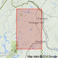
Type locality designated as along east bank of south branch of Presque Isle Brook, about 1 mi from south line of Chapman Township and 1 mi west of Tweedy on road running southwest from Presque Isle. Consists mainly of thick-bedded sandstones with some shaly layers. Thickness exceeds 500 ft. Fauna seem to correlate closely with Lower Oriskany of NY as recognized at Becraft, and indicates that Chapman is older than Mapleton and Moose River sandstones and younger than Square Lake limestone.
Source: GNU records (USGS DDS-6; Reston GNULEX).
For more information, please contact Nancy Stamm, Geologic Names Committee Secretary.
Asterisk (*) indicates published by U.S. Geological Survey authors.
"No current usage" (†) implies that a name has been abandoned or has fallen into disuse. Former usage and, if known, replacement name given in parentheses ( ).
Slash (/) indicates name conflicts with nomenclatural guidelines (CSN, 1933; ACSN, 1961, 1970; NACSN, 1983, 2005, 2021). May be explained within brackets ([ ]).